

John Hesp's Hike Across Scotland 11
TGO Challenge - A Walk from Glenuig to Montrose
Day 10 Sunday
I woke up at 1:30 to find heavy condensation in the tent. In my hurry to put it up before the rain I’d forgotten to open both end vents which I’d partly closed at the windy Blair Atholl campsite. I was awake again at seven, and lay in bed planning my route for the next couple of days, listening to the sound of occasional showers drumming on the tent a few inches above my head.
Today’s planned route was to walk east across over the low hills to Spittal of Glenshee, and then head NE to camp in Glen Brighty. But as was becoming the habit, this isn’t what I did, instead diverting from Glenshee over the Munros Creag Leacach and Glas Maol, and dropping down into upper Glen Isla to camp. This was part of my resolve to make things more exciting where I could.
A couple of backpackers were walking up the slope from the corner of the wood as I went out for water. Some people from one of the houses I’d passed in the glen yesterday had come up to the loch to fish.
I was away at nine, following in the footsteps of the backpackers I’d seen earlier. A fence ran in the right direction and a little higher up I found the day looked increasingly promising. It had been a bit dark and humid at my campsite under the trees.
Cutting down behind Elrig I found myself on a track heading north up a glen and set off up it, but I hadn’t gone more than a few metres when a building appeared around the corner.


This was too good an offer to miss, so I stopped for a bite to eat. Looking in the guest book on the table I found that Irene and Les, the couple I'd met a few days ago near Loch Rannoch, had looked in thirty minutes before me, and over a hundred years before them Queen Victoria had stopped for a snack. Gorp and flapjack?

A pleasant stream-side pull up the glen to An Lairig (The Pass) followed, and then a new scene opened up – the Spittall of Glenshee and it’s surrounding hills.

The Spittal of Glenshee
I hurried down and went into the hotel just as Irene and Les were coming out. We had a chat, and as we were continually running into each other we compared routes ahead, they were heading further south than me so I probably wouldn’t see them again. In fact I saw them at Montrose where they had arrived a few minutes before me.
I had a good look at my maps whilst enjoying hot chocolate and carrot cake in the hotel. As the weather was improving I decided to divert over the Munros to the north of Spittal of Glenshee – Craig Leacach and Glas Maol – and then drop down to the rugged looking upper Glen Isla.
I’d been following the Cateran Trail since the Upper Lunch Hut, but at the ominous sounding Tomb (actually a rather nice cottage) I turned north, following a track then a path up to the bealach between Carn Chomh-Stri and Carn Aig Mhala, where I stopped for lunch whist still reasonably sheltered from the cold east wind that was blowing.

At least it was sunny now, with large clouds racing by a little higher up. Lunch was a rolls, ham, cheese and coleslaw, bought in the shop in Blair Atholl yesterday. I had wondered about getting an early lunch in the hotel at Spittal of Glenshee, but this was much better. Massive views to the south and west.
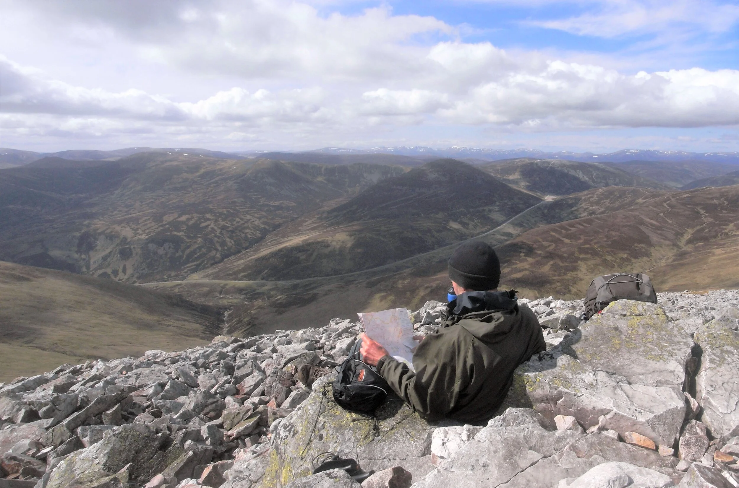
A final pull up steeper slopes brought me to Craig Leacach at 4pm. From here it was gentle slopes to the higher Glas Maol. A man made object attracted my attention near the summit, and walking over I found what looked like a crashed microlight. The summit cairn is a semi-circular wind shelter, unfortunately facing the wrong way for today’s easterly. I took a photo of myself on the cairn at 5pm.....

On Glas Maol
…..and then headed off down to the SE to pick up the track to Monega Hill. Looking down the cliffs into Caenlochan Glen was surprisingly dramatic.


Looking down into Caenlochan Glen
Once down into the glen I turned north up the glen to have a look at Bessies cairn and then found a place to camp at 6:30pm. I couldn’t see the bridge marked on the map so waded across the river to a good looking spot. Being on the east side of the river would put me in a good position to ascend Finalty Hill tomorrow.
I had a risotto for dinner followed by cups of tea, but although I still had the 100g gas canister I’d bought in Blair, I knew I’d better not use too much gas. Maybe it was overpriced, but another 100g canister would have made life a bit more pleasant.

I was feeling quite pleased with myself for taking advantage of the good weather and coming over the hills to end up in this dramatic glen and I was also now well placed to go over Mayar and Driesh the next day.

