


Exmoor Walks: Dunster Walk Inspired by The Deer Park
Even though it’s been on sale for only 3 days I am already getting lots of positive messages about my modern fairy-story, The Deer Park - and a lot of people want to know more about the exact location I’ve based it on…

Well, here’s an old newspaper hike which I wrote as a way of getting people to visit the Land of the Giants. This is not, as it happens, a reference to anything in my book (although there is a giant in it). This classic walk introduces us to a grove of trees which are the tallest in England.
The Dunster Douglas even has its own plaque to confirm it’s the country’s tallest tree. The giant douglas fir has been growing since 1876 and is now just a single foot short of 200 feet (60.5 metres). The plaque also informs us that its trunk weighs 50 tonnes - which would be enough wood to make 4.5 million pencils.
Fantastic... Indeed, a stroll through the Valley of the Giants is a fantastic, awe-inspiring, experience which I’d recommend to all country-lovers.
This particular hike has the valley as it’s ultimate goal - you can reach it far more easily by car if you’re feeling lazy.
To try them out for the first time I went to the forested hills behind Dunster which offer as wide a cross-section of walking conditions that you’ll find in this region. There are steep rocky tracks, open heaths, stream to cross and some muddy sections - which just about encapsulates most terrain you will come across in the South West.
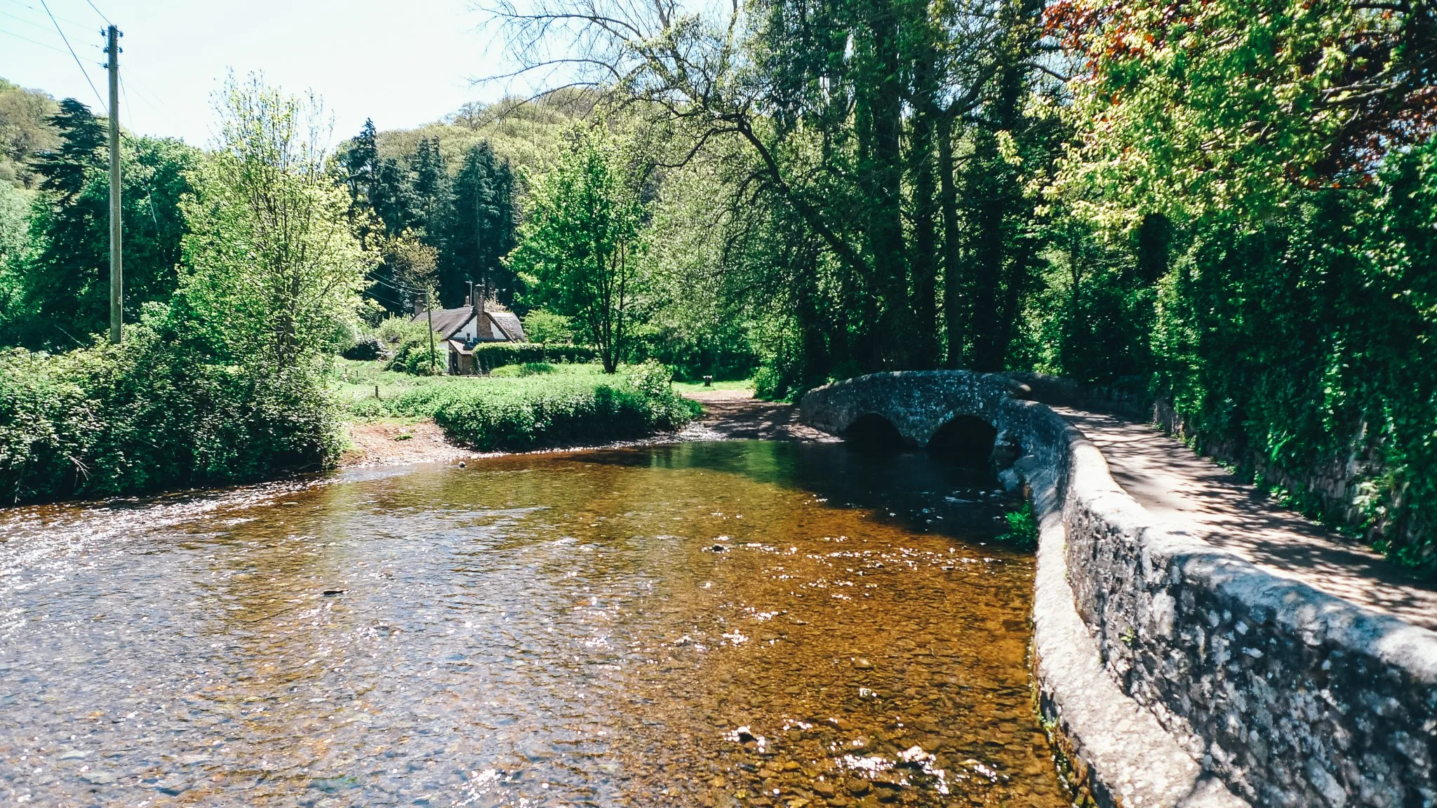
Having parked in the small car park near Gallox Bridge (turn left at the Forester’s Arms as you leave the village on the Wheddon Cross road) I followed the old packhorse trail into the hills south of Dunster.

The packmen of old used to frequent an inn called the Horse and Crook somewhere around here – the pub’s long gone, but they used to take their trains of horses, mules and donkeys across the old packhorse bridge that still stands at Gallox.
If you look over your right shoulder while walking across the bridge, you will see Grabbist from where, legend has it, a super-sized ogre used to reside at the locally named 'Giants Seat'. Apparently he was a nice old giant, the villagers would get him to dry their washing by wafting one of his huge hands.
The village has another ancient giant legend which claims one huge fellow had been locked in a dungeon. This one eventually turned out to be true - a massive manacled skeleton was uncovered during the last century in Dunster Castle's Gatehouse.

Dunster Castle Gatehouse where the giant was unearthed
Having reached the forest gate above Gallox Bridge, I turned left and followed the path towards Carhampton. This can be muddy - and was the other day - but the Brashers gave good grip. The track took me up over a pleasant corner of down-land, affording the most fantastic and unusual views of the famous castle.

Track to Carhampton Gate
At Carhampton Gate, we come to the old deer park boundary. I turned right and followed it along a track called Park Lane which ascended up over the hill to Withycombe Hill Gate.
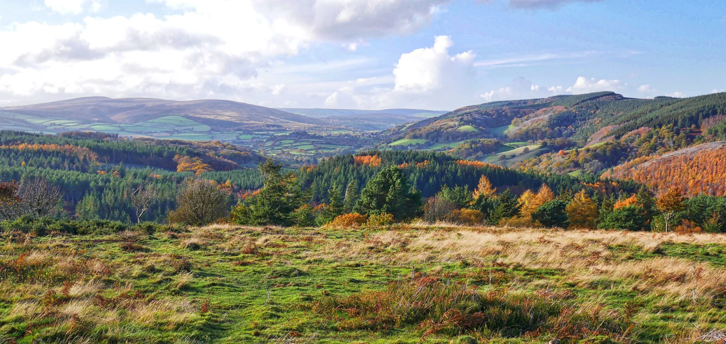
At this point you could - if you wanted a shorter hike without the giant trees - re-enter the park by walking through the gate on your right to continue straight on, out onto the big bald hill that plays host to Bat’s Castle. This is one of the most tremendous prehistoric remains in the West Country – and I say that not only because of its extraordinary ramparts, but because of the sublime views you get in just about every direction from the top.

View from Bat’s Castle
In fact, you get more-or-less the same view of the Avill Valley running up to the high point of Dunkery Beacon as the one Mrs Cecil Frances Alexander enjoyed from Grabbist more than a century ago. She was so impressed that she wrote the famous hymn 'All Things Bright and Beautiful'. Dunkery might not be exactly a "purple headed mountain" - but the rest of the hymns rings as a pretty true description of village and vale.

However, I did the exact opposite and turned left instead along a footpath which lead me out onto Aller Hill. Heading south, this right of way now quits the trees and strikes out over some rough open land. Curving to the south-east it descends along side a wood, crosses a small stream, and then begins a direct ascent up the hill which plays host to Gupworthy Farm.
We pass the path which leads to the farm on our left and continue on upwards towards the beautiful named woodlands called Withycombe Scruffets (or Scrubbetts, depending on which spelling you prefer). After about a mile - and just before we reach open heathland - a track descends to our right and this will take you down into Longcombe.

Bat’s Castle hill looking south-west towards Dunkery
Once you reach the very bottom of the valley, take any of the forestry tracks which wend their way around Longcombe Hill to continue west past Broadwood Farm to reach the wood of that name.
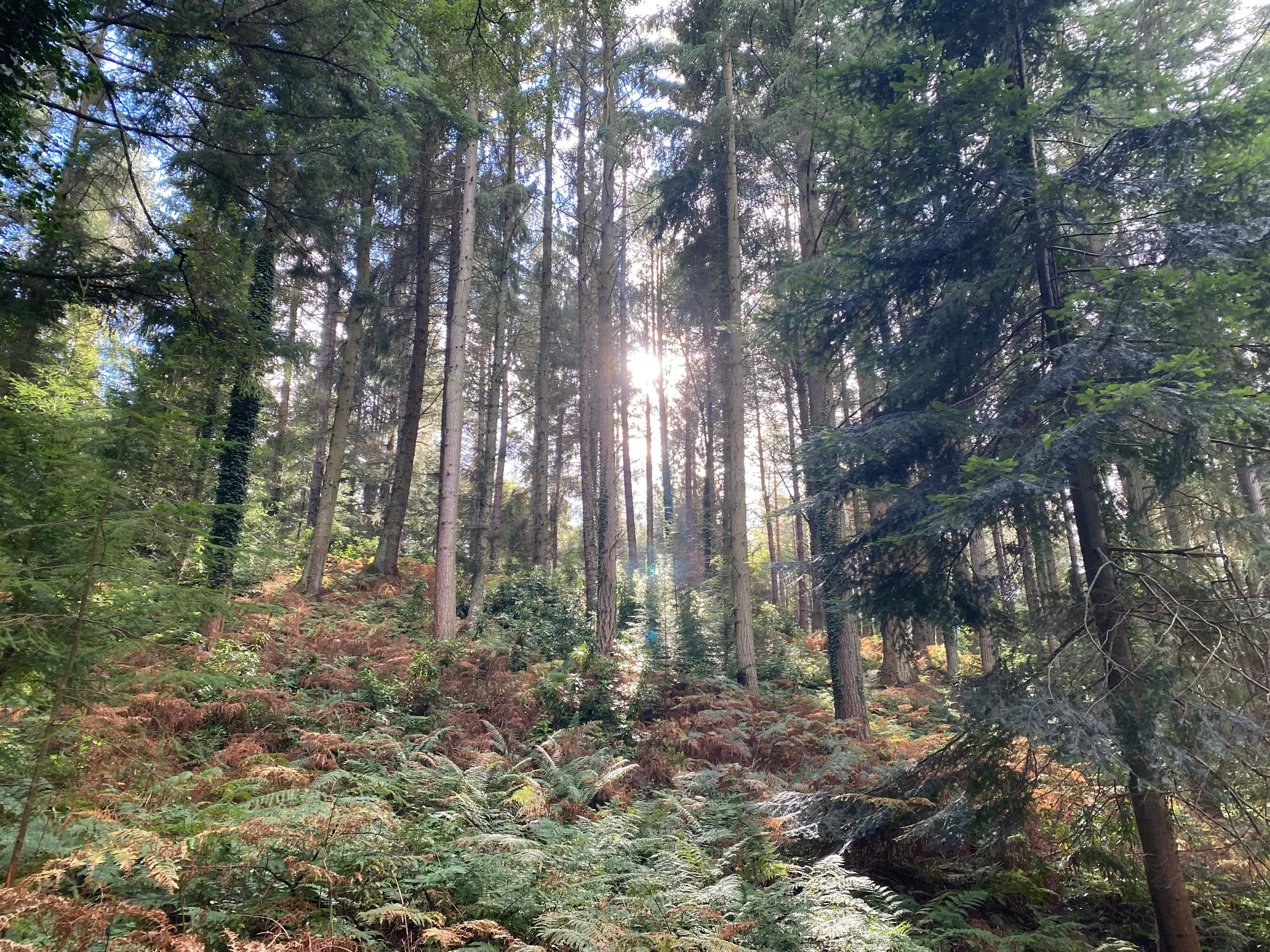
Now swing north to get onto the Broadwood Road - and within a couple of minutes you are dwarfed as you stroll amid the gargantuan conifers. Actually, most are conifers but Dunster Douglas stands right next to the country’s tallest magnolia - measuring a modest 80 feet in height.
The Crown Estate developed a Tall Tree Trail around the valley, says that the warm damp climate of the coombe and its perfect soil combination has allowed the giants to grow so tall.
We pass out of the trail’s northern end and follow the little paved lane for a few hundred yards across some meadows until the woodlands begin again. This is where we leave the lane to join tracks on our right which start climbing around Gallox Hill.
Yet more stunning views can be enjoyed from the top where the trees thin out to open heath. We continue around the northern end of the eminence (which is actually called Vinegar Hill) to descend along a track that leads east directly back to the packhorse bridge.
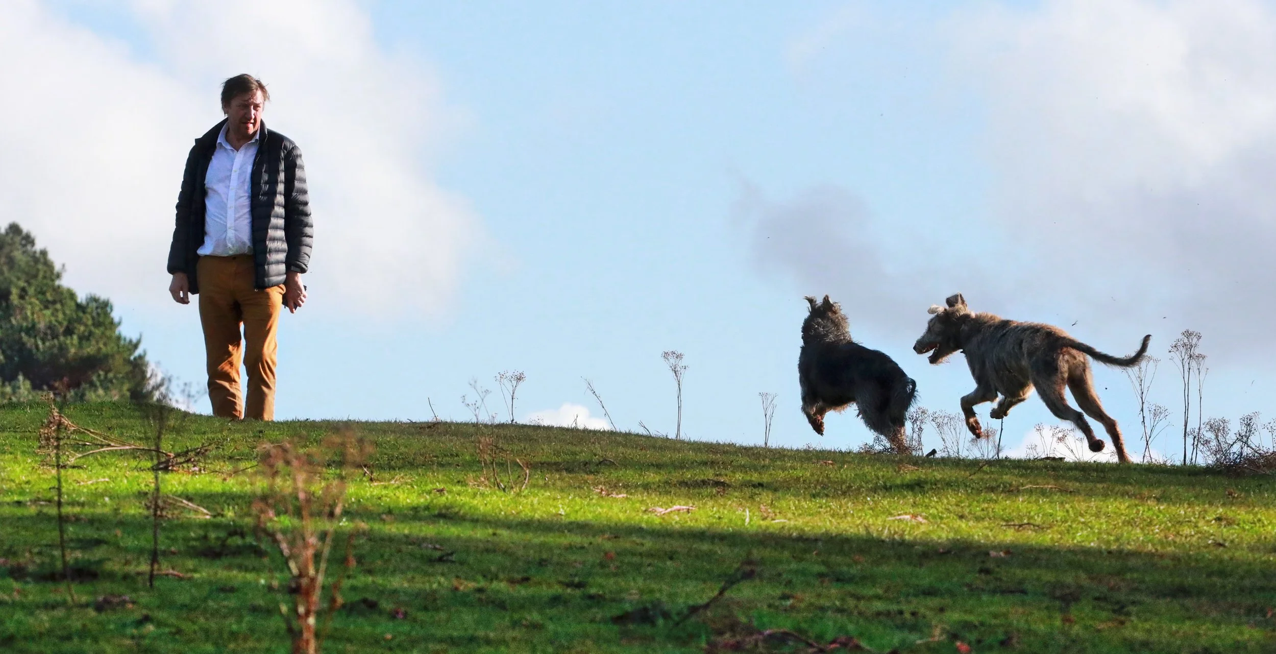
Martin Hesp with lurchers at Dunster Deer Park
Fact File
Basic hike: from the southerly quarter of Dunster, across Gallox Bridge to the Deer Park. East to Carhampton Gate, south to Withycombe Hill Gate, south past Gupworthy Farm, across Longombe, past Broadwood Farm to head north via Tall Tree Trail to Gallox Hill and back around Vinegar Hill.
Recommended map: Ordnance Survey Explorer OL9 Exmoor.
Distance and going: six miles, a little steep in places – can be muddy.

