Cornish Walks: Godolphin Hill
Keen walking types will know all about Munroes - they're British hills, mountains and peaks that manage to haul themselves more than 3,000 feet above sea-level. The collective name comes from one Sir Hector Munro who compiled the first catalogue of more than 280 such elevations in the early 1900's. Climbing and hiking enthusiasts go mad attempting to 'bag' all the Munroes, often turning mild eagerness into wild passion during the quest.

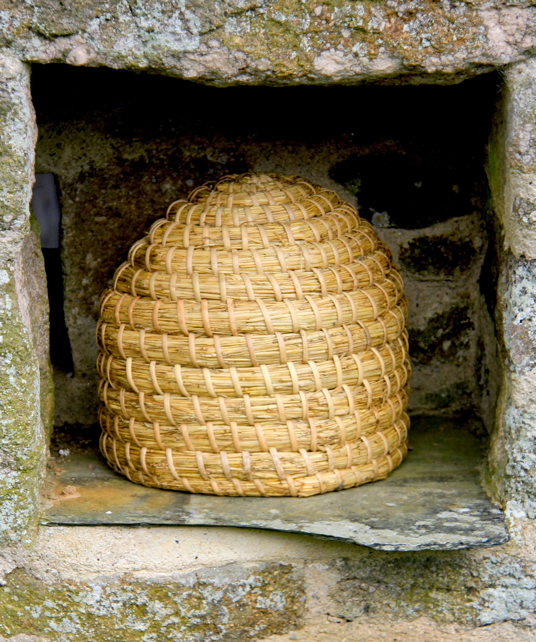
The old house at the Godolphin Estate lies quietly in hidden gardens underneath the hill
But the big peaks are all far to the north of the West Country - not a single grain of South West soil comes anywhere close to the rarefied altitude of 3,000 feet. However, I don't see why we should be excluded from all the fun. We have big hills - mighty eminences that can be seen from Devon-pillar to Cornish-post - and I can think of nothing better than to collect these colossi.

Godolphin Hill as seen from neighbouring Tregonning Hill
I've notched up another mount on my list of great West Country hillocks. Godolphin Hill is as fine a mound as any. It is perfectly formed - being almost completely dome-shape. It rises high among lowlands (unlike most of those Scottish Munroes which have lofty brothers and sisters to contend with). And it is relatively close to two different seas so you get salty, fabulous views of both the English Channel and the Atlantic at its remarkable summit. Added to this, it is owned by the National Trust, so you can wander about its airy, springy, peaty heaths where'er you will.
The Trust hasn't owned the big estate at Godolphin for long, and is still in the process of consolidating its new holding. For instance, some excellent new literature is at present on its way to the printers, and it will go a long way to explaining Godolphin's long and fascinating history. In the meantime there is a shorter leaflet which will help you get around the place and enjoy the numerous walks which stretch from riverside woodlands to craggy downs.


Having completely misread this leaflet's map, my exploration of the estate started sort of head-over-heals. The pictorial diagram is printed so that north points towards the bottom of the page - which always confuses a dullard like me. And so I found myself near the Leeds Shaft chimney of the Great Work Mine rather than at the twin car parks near Godolphin House.
You'll find the perpendicular industrial relic on the shoulder of land between Godolphin and Tregonning Hills (I know I said Godolphin is set amidst lowlands - and it is - with the one exception of this neighbouring southerly spur) which you can reach by taking the lane that leads up to the watershed from the village of Godolphin Cross (about three-and-a-half-miles north-west of Helston). At the top of the lane the National Trust has built a car park adjacent to the massive chimney and engine house.
It doesn't really matter which direction you approach Godolphin Hill from, you are guaranteed a good walk and here - at wonderfully named Mount Whistle - you are closest to the summit. Before walking a few yards up the Millpool lane to find the footpath, I took a quick look at the engine house. The Trust has cleared the scrub so that you can explore the place, but don't go if you're frightened of big black holes. At the foot of the chimney there is a bottomless pit leading to Hell I should think, thankfully capped by a heavy-duty grating so that you can peer into the void without fear of falling in.
The traveller John Leland was impressed by this mine when he visited in 1538 - he wrote: "There are no greater Tynne (tin) works yn al Cornwall than be on Sir William Godolcan's ground." Apparently Leland wasn't exaggerating - two centuries later people were still recording the fact that this was the most productive tin mine in the county. The Leeds Shaft engine house, built in 1829 to house a 60-inch pumping engine, is the last remnant of the workings. The place eventually closed in the 1890's, but was briefly reopened for an unsuccessful bout of grubbing about in the 1930's.


The spelling Godolcan (or Godolghan) was used way back in the 12th century when the family took their name from the place where they'd built their manor. "Through mineral wealth, land expansion and judicious marriages the Godolghans gradually secured their position as one of the foremost families in Cornwall," explains the yet-to-be printed Trust leaflet.
Having met their Lordships, let us enter what was once their private demesne. The footpath heads north towards Godolphin Hill between a productive looking leek field and a yard full of junk. Somehow, I don't mind junk - it's all part of the charm of some parts of the countryside - and certainly this corner of Cornwall. You get the feeling that the people around here are farmers and flower growers rather than tourism providers.
We gain access to the moorland by crossing an ancient granite stile. Paths shoot off in all directions, but it was cold and I was in a hurry to make a beeline to the top. Be warned - the footpath that heads due north towards the summit will take you there, but it does switch and turn so that, occasionally, you are tempted to take one of the smaller paths that looks more determined in its upward course. Don't. You'll be lead on a wild and brambly goose-chase. Stick with the bendy one, and it'll get you to Godolphin's summit eventually.


And what a worthwhile climb it is. You can see almost all of West Cornwall - from the giant dishes of Goonhilly Down to the south, right around the coast to St Michael's Mount five miles distant, and beyond to Penzance in the west. There's an excellent panorama of the moors of Penwith and these lead up to distant St Ives where our view of the north coast begins - stretching past Hayle and its Towans all the way to St Agnes Beacon and Carn Brea.
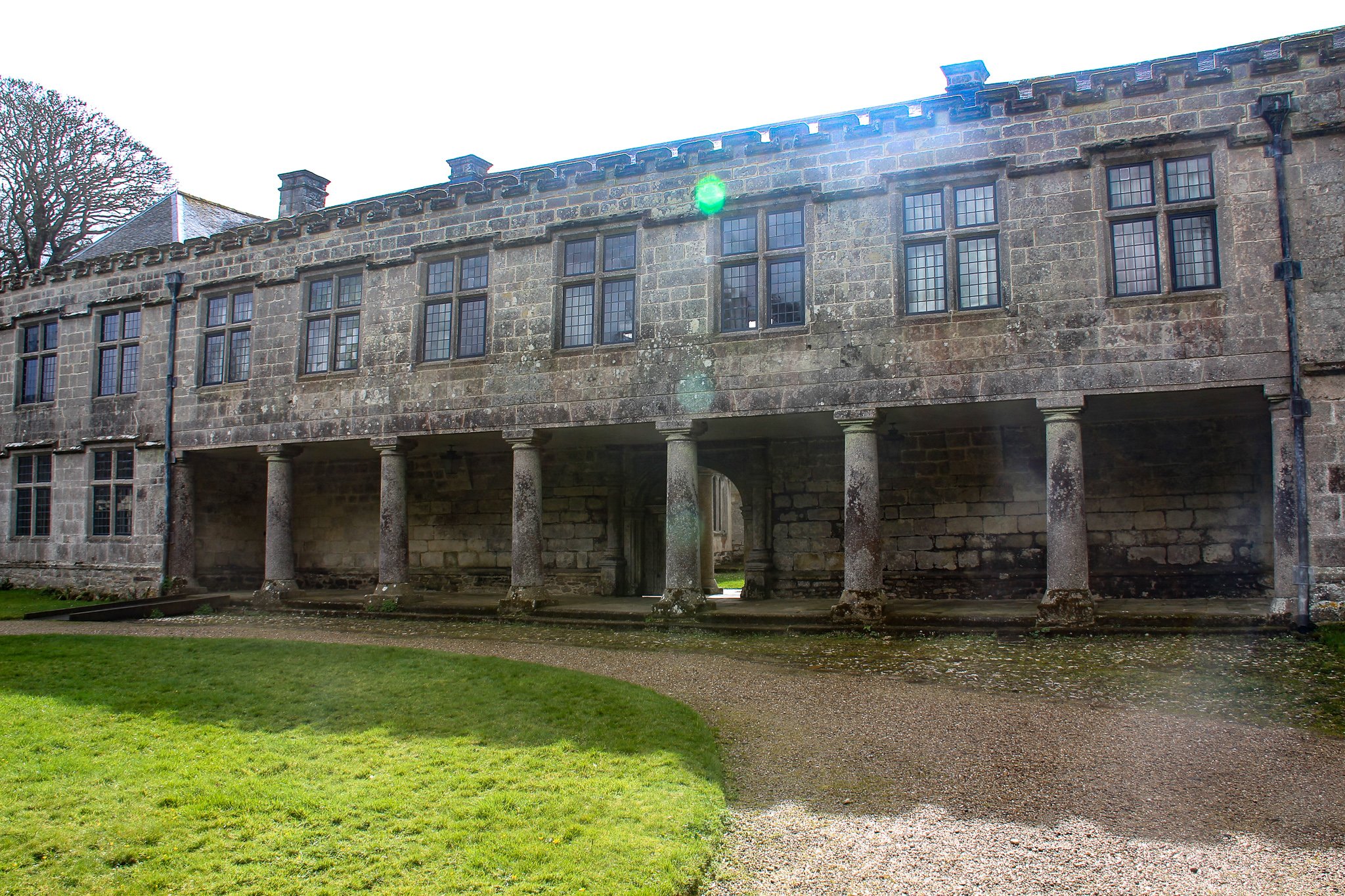
A path took me north-east, down from the summit to a wood-lined lane called The Slips, which in turn took me to the edge of the garden at Godolphin House. This is still owned by the Schofield family (who sold the rest of the 550 acre estate to the Trust) and the place was covered head-to-foot in scaffold as I walked by. But I believe the house is sometimes open to the public (tel: 01736 763194 for details) and is reckoned to be "easily the largest and grandest house in 17th century Cornwall," according to the Trust leaflet.
The land continues to descend north, down through woods to the River Hayle and, as much of this is owned by the Trust and riddled with footpaths and interest, I shall return again. But, time was pressing, so I turned west along a track called Vane's Lane which skirted the hill to the west until I reached another path on the left - which returned me, along the side of a field, up to the moorland part of the hill. Now it was simply a matter of turning right and following the perimeter path around the western base of the great cone, back to the ancient granite stile.
Godolphin Hill might not be 3,000 feet - in fact it's only a humble 517 - but it's well worth climbing.


Fact File
Basic hike: from Leeds Shaft of the Great Work Mine (three miles north of the A394 Helston-Marazion road) up Godolphin Hill, then onwards to Godolphin House - to return via footpaths around western flank of the hill.
Recommended Map: Ordnance Survey Explorer 102 (Land's End) - or National Trust Leaflets (extensive updated version available soon).
Distance and Going: Three-and-half miles easy going.