


Somerset Walks: Kilve to Lilstock Shoreline
With summer well and truly on its way, now is the perfect time to consider extending the nation's longest single right-of-way along the Somerset coast to the River Parrett.
Getting to the Start of the Hike at Kilve Village

To begin the hike, make your way to the village of Kilve on the northern slopes of the Quantock Hills. Turn off the A39 Bridgwater-Minehead road and head north towards the beach. Pass the ancient Chantry ruins and continue down the bumpy lane to the small car park near the cliffs.

Exploring Kilve Beach's Unique Geological Features
The beach at Kilve, a designated Site of Geological Special Scientific Interest, is home to unique blue lias pavements and fossils, making it one of the most fascinating beaches in the country. Some rocks along the beach contain shale oil, which can cause them to catch fire in certain conditions.

The old oil retort at Kilve
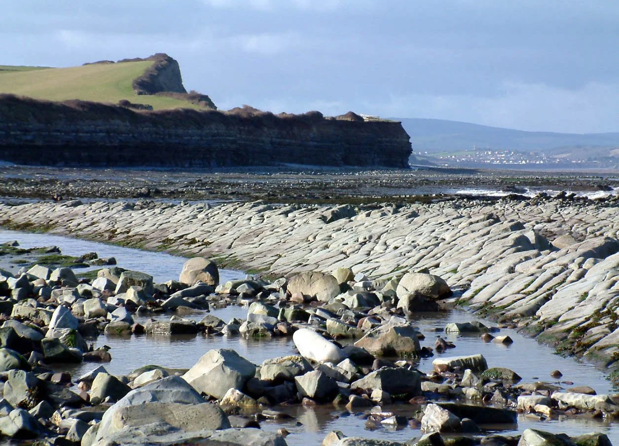
Clifftop Views and Royal Navy Observation Post
From Kilve, follow the clifftop path eastwards, enjoying the breathtaking views of the northern Quantock and Blue Anchor Bay. Look out for the Range Quadrant Hut, a white-painted structure on the edge of the cliffs where Royal Navy observers watch military exercises.

Kilve Beach with observation post in distance
Uncovering the Haunting History of Lilstock
Further along the path, you'll reach Lilstock, a location steeped in history and mystery. Once home to a bustling harbour and hotel, Lilstock now offers only haunting remnants of its past. As you return to Kilve, you can either follow the same coastal path or take an inland route past Kilton, which offers a different perspective on this stunning area.

Lilstock beach with remains of harbour
Fact File
Basic Hike: from Kilve Beach, on the West Somerset coast, east along the clifftop path to Lilstock - and then back, either via the same route or over the hill past Kilton.
Recommended map: Ordnance Survey Explorer 140 - Quantock Hills.
Distance and going: three-and-a-half - or five miles depending on return route. Very easy going.

St Nicholas at Kilton
