

John Hesp's Hike Across Scotland 4
TGO Challenge - A Walk from Glenuig to Montrose
Sunday, the third day
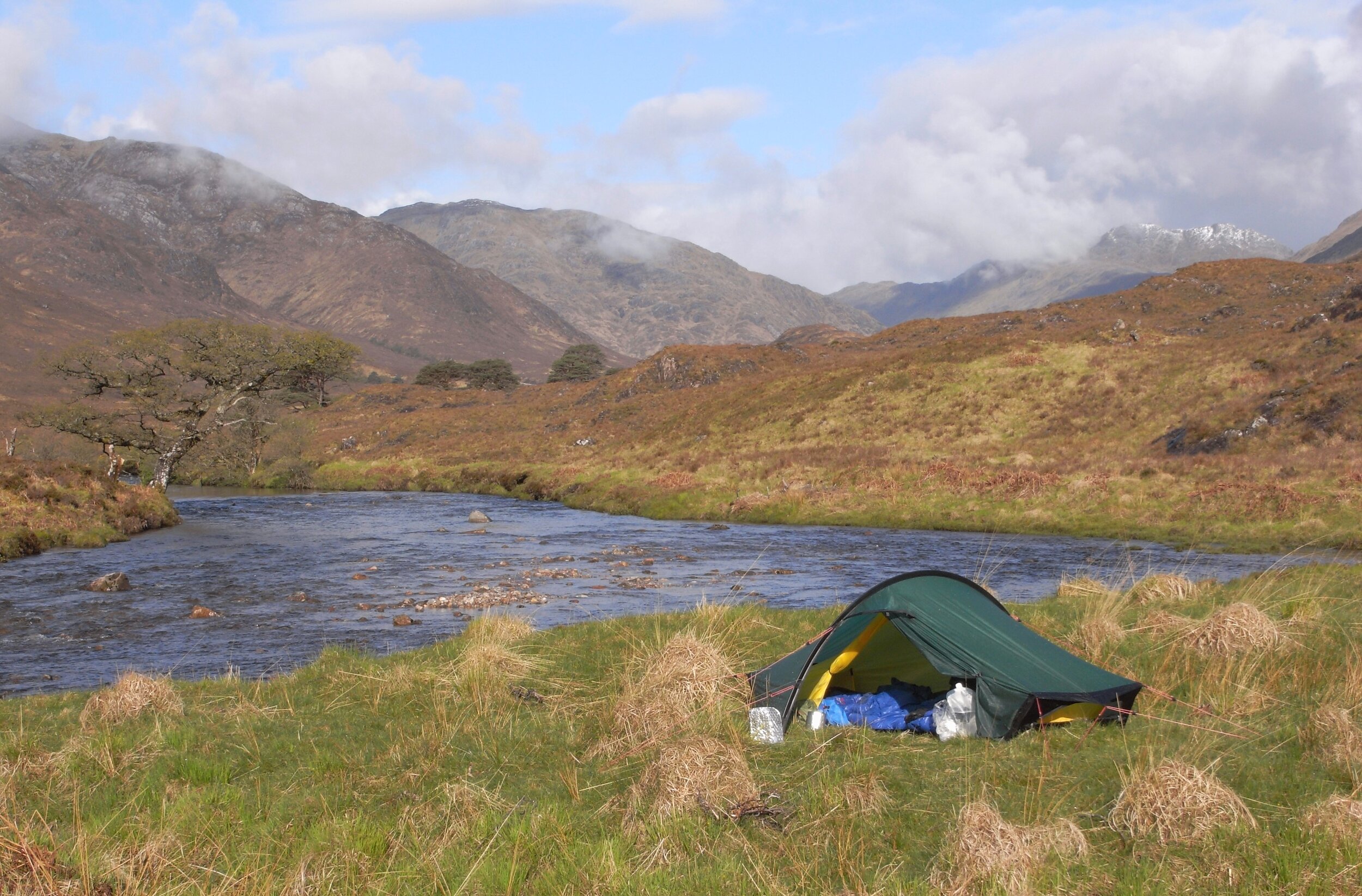
I woke from a deep sleep at eight. It seemed very bright even for eight o’clock, and unzipping the tent door I found myself looking across the river at the scots pines straggling up the slope opposite. Higher up a thin band of cloud clung to the mountain, but the ridge above was silhouetted against a blue sky.
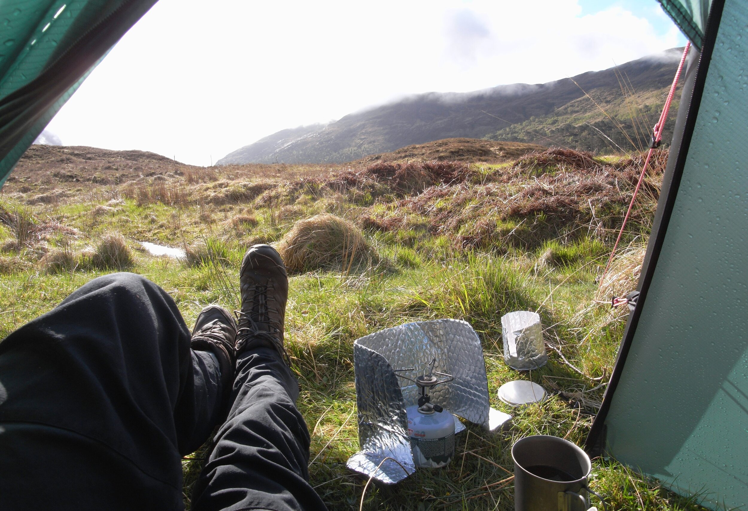
I lay in my sleeping bag propped up on one arm eating breakfast and writing my log – “All nervousness about the trip gone now. The hardest part behind me now, looks like better weather, and I’ve really got into the swing of it. Sunshine helps!”
Breakfast was always muesli. I like breakfast and I like muesli. For this trip I’d treated myself to a so called “premium” muesli, and in my enthusiasm for this muesli I’d even put an extra bag of it into my rucksack at the last minute. Unfortunately I wasn’t as keen on it as I’d expected, and had much smaller breakfasts than usual. This didn’t seem important at the time, but looking back on it this was a mistake. I don’t think I ate enough of the right stuff on the trip.
Today’s route would take me down Cona Glen to Loch Linnhe which I would cross on the Corran Ferry, then inland a bit to a suitable camp spot. The luxury of sunshine made for a very late start, and it was ten thirty before I was away, and then there were frequent stops for photos and just to look at things.


Lower Cona Glen was really nice with old scots pines dotted about, frequent waterfalls and some very nice camping spots.

Much lower down Cona Glen joins Glen Scaddle and then a mile later we were back at sea level again at Inverscaddle Bay on Loch Linnhe. Across the loch Ben Nevis had a good covering of snow.

Ben Nevis across Loch Linnhe. Some cycle tourists in the foreground
Loch Linnhe is a continuation of the Great Glen fault, and all Challengers except those starting in Oban or Ardrishaig have to cross this fault line and get funnelled into surprisingly few crossing places. I was crossing at Corran Ferry a few miles further down the loch from Inverscaddle. This meant another walk along the A861, the road I’d walked along on the first day from Glenuig, but this section is even quieter as it doesn’t really go anywhere. Of the few vehicles that passed me most were motorcycle tourists. The road is more a lane than an “A” road.
The road follows the edge of the loch to Corran ferry and after a while I stopped for lunch on a beach looking across at Ben Nevis. I phoned home and sent a text to a friend who lives on Islay in case he happened to be up this way in his sailing boat. It was great to sit in the sun for lunch and not feel rushed.
It was nice to include a boat trip on the walk, and the Corran Ferry was free to pedestrians which made it all the more pleasing. It was my brother Martin and his partner Sue who first took me to Scotland in about 1978. We made the journey in an old ex-GPO Morris Minor van which would only start if pushed, and I still smile at the memory of us bump starting the van on the Corran Ferry. The front wheel fell off a few days after we got home.

Once on the “mainland” (Ardgour, which I’d just left, is virtually an island, and I believe was an island in the past when sea levels were higher) I walked through the village of Inchree and up a side road to a forestry visitor area where I made use of a picnic table for a snack stop (I was always ready for a snack stop), and then followed a path up the hill past a rather spectacular waterfall.

The path joined a forestry track, and after a while I found another track which dropped back down to the river, the Abhainn Righ, where I camped, a couple of hundred yards above the waterfall. I was a bit apprehensive about finding a camp spot as it’s a steep sided valley thick with trees, but I found a very nice site right beside the river just below the footbridge. It looked a bit scruffy at first glance, but it’s funny how what at first seems a bit unsatisfactory becomes the ideal camp spot once the tent is up. Sunshine, bird song and the rushing river; what could be better?
I had noodles with a home dehydrated sauce for dinner. All dinners on the trip were ones I had dehydrated at home and were quite successful in that they more or less fed me. The rice pudding I’d dehydrated didn’t work so well however. For some reason it refused to re-hydrate properly even after leaving it for an hour. When re-hydrating the food it’s added to a pan of water, boiled on the stove, and then the pan of food is put into an insulating sleeve which keeps it remarkably hot for a very long time. The rice pudding stayed as flakes floating in a milky soup. I ate it anyway, and then bed at 9:30 with a great feeling of satisfaction at the end of the first sunny day.


