

Somerset Walks - Brent Knoll
The Monty Python team used to do a sketch about what they called the Bleedin’ Obvious - and in a way you can follow that theme when it comes to selecting a walking route.
This usually means hiking up some large eminence or other where the aim is simply to get to the top to enjoy the view . No single bit of terra firma in the entire West Country is more bleedin’ obvious than Brent Knoll – the great big mini-mountain that presides over the M5 motorway just north of Bridgwater. It looms like some vast sentinel guarding the very gateway to the region.

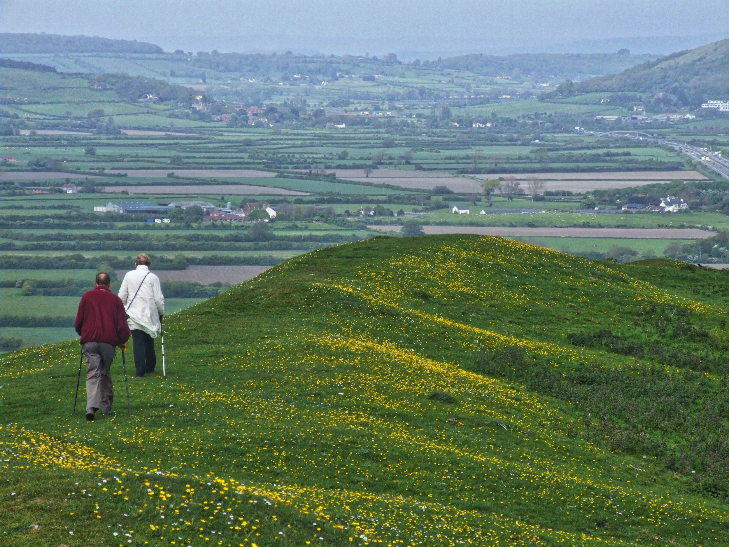
Walking along the top of Brent Knoll
I have long argued that the West Country begins and ends on a line that you can draw from Brean Down on the Bristol Channel coast to Portland Bill in the English Channel – and Brent Knoll is one of the biggest, most noticeable eminences along that border.
It is one of those places you’ve driven past a thousand times and each time you say to yourself: “I must go up there one day. I really, really must.”
My father had been saying that for more than half a century, which is why I took him and my mum up with me one day a few years ago. This also proves the point that just about anyone can scale this steep mini-mountain, even if its slopes are steep – my dad was in his 80s when we did this walk.
Recently £11,000 was spent on laying a footpath up to the National Trust owned summit, so that makes thing easier - though we didn’t ascend that way.
Fact File
Basic Walk – a circular route over and around Brent Knoll, starting at the village of East Knoll on Weston-Super-Mare road to north of hill.
Distance and going: three miles, fairly gentle except for one steep climb and descent.
Recommended map: Ordnance Survey Explorer 153

There are many public paths that surround the 449 foot knoll including several that pass over it, but we did a circular route from oddly named East Brent – I say odd because, given its location, I cannot fathom why it isn’t called North Brent instead.
Anyway, it is a village that straddles one of the main roads to Weston-Super-Mare – which doesn’t endear me to it, but the village church with its beautiful spire does. We parked near this elegant temple and set off directly for the Knoll which we could see looming to the south.
A footpath ascends through pleasant fields with the views getting bigger each step of the way – but they begin to really unfold after you reach trust-owned land towards the top. Suddenly the going gets a whole lot steeper – as steep as the proverbial house roof.

At the top… Well, it’s the nearest thing you can do in the West Country to flying in an aeroplane without having your feet leave the ground. There are immense vistas that include the Polden Hills to the south, Glastonbury Tor to the east, the Mendip Hills and Cheddar Gorge to the north east, the Bristol Channel and Wales to the west and the Quantock Hills to the south west.
The Knoll dates from the Jurassic times 300 million years ago when a warm, shallow sea surged around its lower slopes. To this day its local name is Frog Island – but whether this relates to that ancient sea or not, I cannot tell.
The giant outcrop of clays and limestone was a pretty obvious place for Early Man to make his home and subsequently people from the Bronze Age and Iron Age have lived up on the summit. The giant hill fort that crowns the place is still very much in evidence.
The Romans built a temple here, and various coins have been found. The

Anglo-Saxons used of the Knoll as a look-out station to keep watch for Vikings - who duly turned up, as they did in so many West Country locations. There was even a battle in the year 875 when the Saxons managed to beat the Danes. The nearby village still boasts a Battleborough Lane.
By 1086 the Domesday Book was reporting that 250 people were living around the Knoll’s base, keeping just up from the marshy land of the Somerset Levels that were often in flood. In 1607 the whole of the Vale of Avalon flooded to the depth of 12 feet as far as Glastonbury - and just a century later the sea broke across the land again.
Today, standing up there on the Knoll, you still get the impression that it wouldn’t take much to flood the surrounding lowlands.
And it’s down to those lowlands we now go by taking the new-laid path which we find at the south-west corner of the Knoll. It descends sharply at first to reach the fields, then takes one zig-and-zag to reach Manor Farm.

We crossed the lane here and took the footpath to our left which turned westward and took us around the upper edge of a strange steep escarpment which makes up a plateau on Brent Knoll’s seaward slopes.
After passing around the edge of four fields this path eventually arrives at an underground reservoir – which is where we turned to our right and began the easterly journey back to East Brent. Again, the path runs across fairly level fields – seven in all – until it reaches the lane.
We turned left, walked a few yards down the road, then found the footpath on the right to descend across just one meadow to the church with the elegant spire.
It’s only a three mile hike, very straightforward (from the summit you can see every step of the way), but hugely worthwhile as it boasts – without exaggeration - some of the finest panoramas in the region.


