

Cornish Walks - Tregardock, North Cornwall

At first glance the name Narrow Escape might seem a good appellation for a boat, but second thoughts will undoubtedly conjure the idea the vessel’s makers were tempting providence.
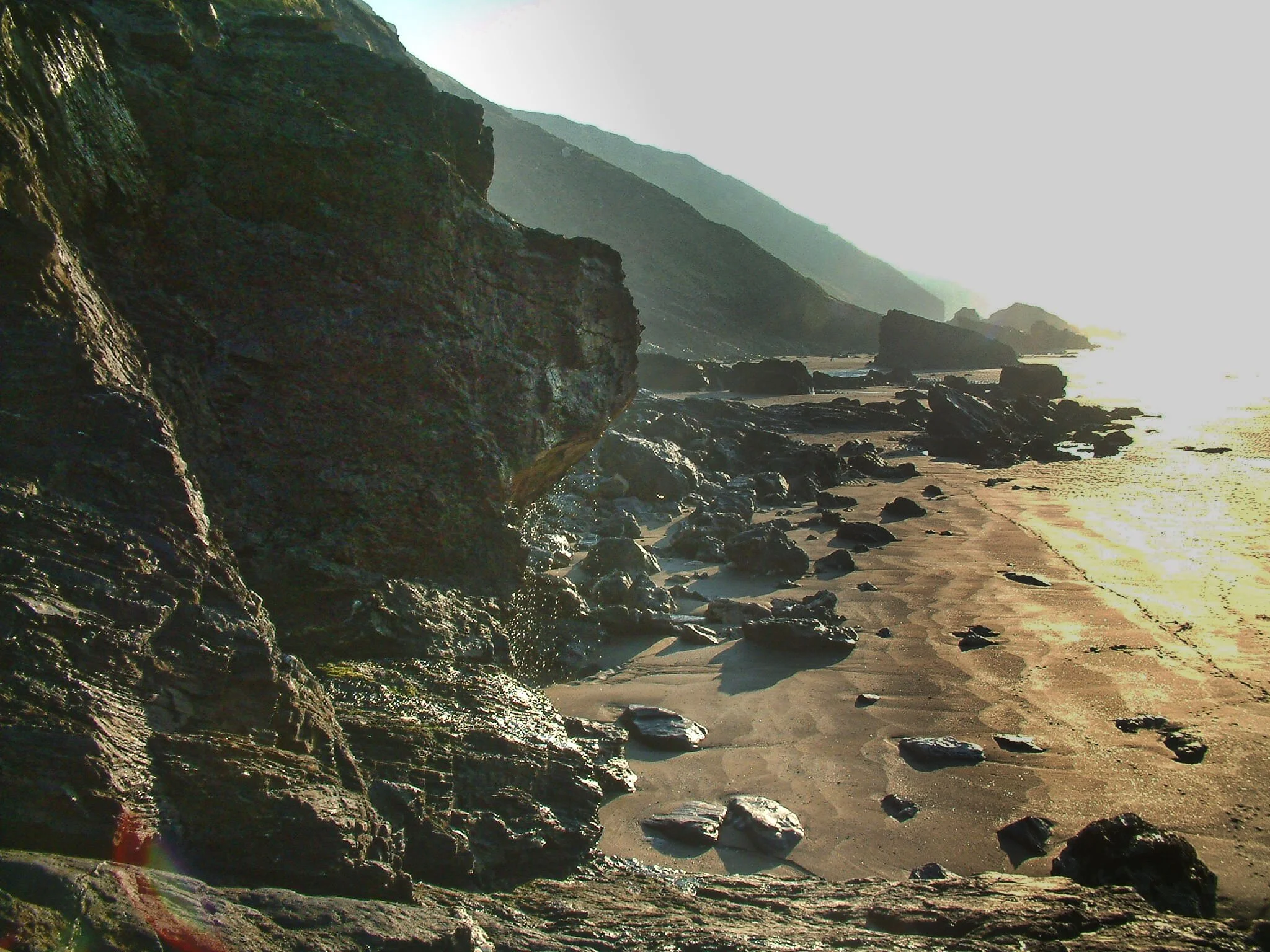
And that's the way it was just over 180 years ago when the Narrow Escape, of Clovelly, failed to live up to her optimistic name and she was smashed to smithereens by a heavy ground swell just south of Tintagel.

But what was she doing there on that lonely, jagged and most inhospitable stretch of the region's coastlines? That's what I wondered as I mused over the inevitable ending of a boat with such a name. There is only one thing for a vessel to do betwixt Tintagel and Port Isaac - steer well clear.
But then, I'm a modern man - a fair-weather sailor in more ways than one. Back in 1826 they did things with their boats that mariners wouldn't dream of doing today. Like pulling up on the sand between the rocks at places like Tregardock Beach to take on Delabole slate.
Crazy. You'd need to be the sort of optimist that calls your boat Narrow Escape to think you could get away with that - although she wasn't the only vessel to come to grief loading the grey gold of Delabole. Reading about this suicidal trade, I made up my mind to visit this treacherous stretch of coast.
To do so I turned down the coastal lane off the B3314 at Westdowns and discovered another bye-way which would take me toward The Mountain.
That is the name of the eminence that commands the North Cornish coast between Tregonnick Point and Jacket's Point, and it is a central feature of this circular hike.

The lane terminates at a farm called Tregardock and there is just room to park in winter if you don't mind wedging your car up the bank to ensure a clear way for the folk who live there. Just before the road gives way to private property there's a public footpath on the right by a barn, and down this you go towards the sea.
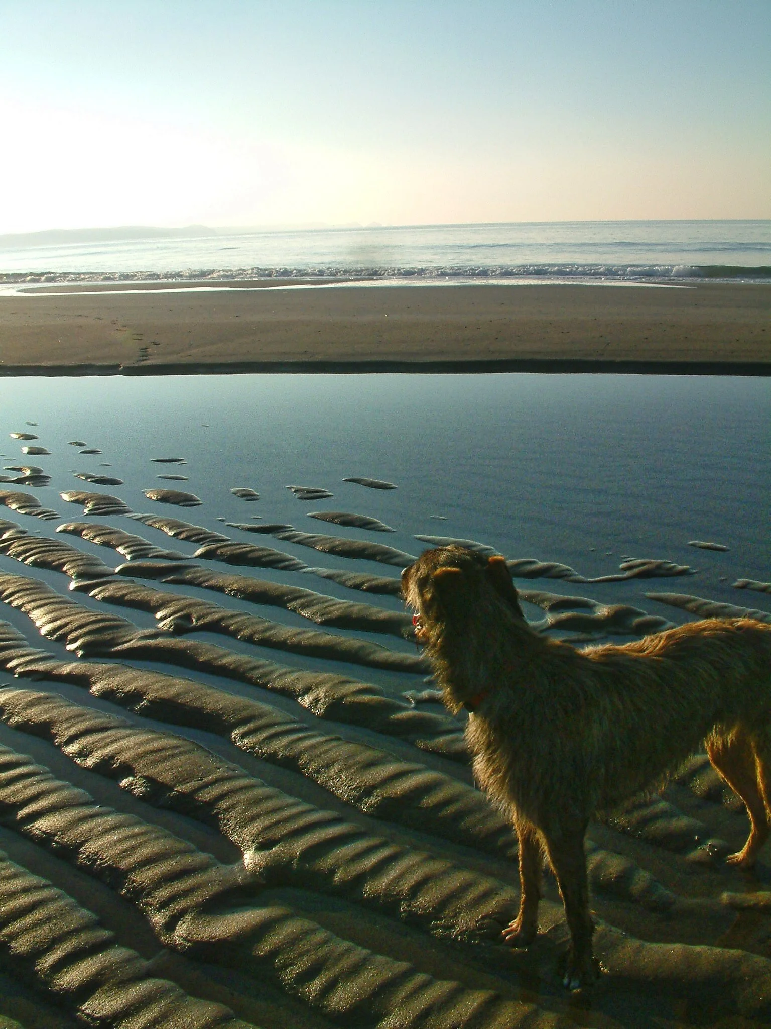
The track curves down a shallow valley to meet the Coast Path. Just beyond the junction - across a shoulder of hill that takes you out of the valley - another path descends towards Tregardock Beach and this I can recommend as a well worthwhile detour if you fancy a paddle or a picnic on the sands.
Alternatively you could yourself a few mussels - the rocks are covered in them. I know people who've come a cropper eating wild shellfish, so I am very careful indeed when it comes to preparing these succulent beauties – basically I only collect them from lonesome beaches far from any sewerage outfall. And you don’t get much lonelier than Tregardock.

I was there once, just before the November snow, and as an icy wind was blowing from the east that day the place was something of a suntrap. Several other people seemed to have realised the same thing, and it was rather pleasant to be on a wild and otherwise empty beach in winter and see a few other kindred spirits.
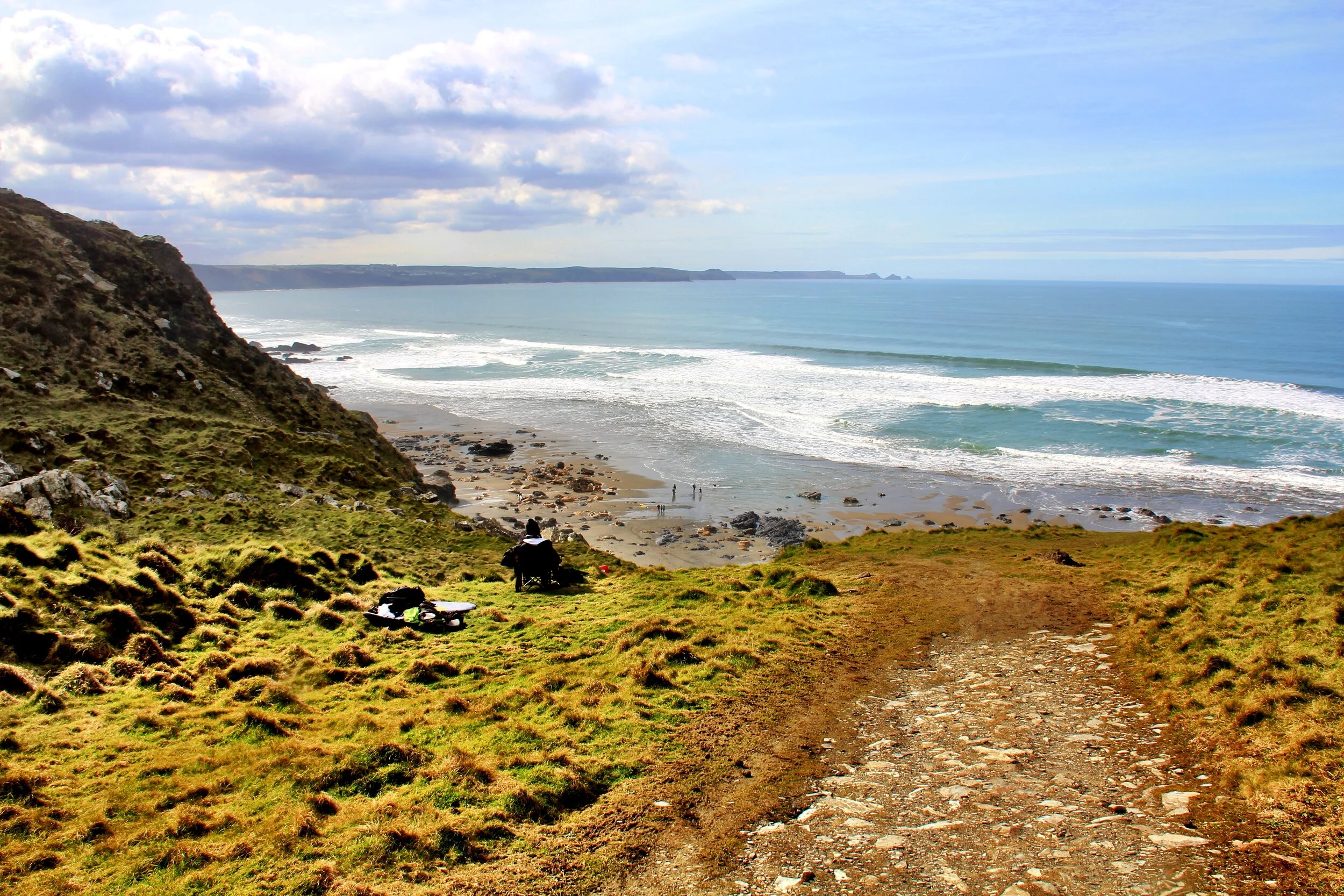
It was a long climb from the beach back up The Mountain, but well worth the effort for the views. J.R.A. Hocking described the area beautifully when writing his book Walking In Cornwall back in the 1930's:
"One wonders why this bare but far from barren country, which is slanted to the sea winds, yet gets some shelter from the enclosing ridge, should be so very deserted...
"There is always a sense of quiet and light and open-hearted peacefulness about it,” writes Hocking. “And yet the whole district is so lonely and out of the way that it would form the nucleus of the National Coastal Park which the C.P.R.E. suggested might be proclaimed between Cambeak and the mouth of the Camel."
This park never happened, alas, but old Hocking would have been relieved to know that great sections of the area are now in the ownership of the National Trust and so are assured eternal protection from the sort of commercial ravages that have attacked nearby Tintagel.

Most of this walk, indeed, is on trust territory. All of the coastal part is anyway, including Tregardock Cliff, which we follow south. Far below, on the lower slopes, a beam engine once provided power for a couple of mines. A savage and unwholesome place to go digging, but they were after silver and antimony, so perhaps it was worth it. I don't know whether they hit lucky or not and would like to hear, if anyone happens to know.
After a while we descend into a deep 'V'-shaped ravine known as Dannonchapel. At least, that's what the National Trust calls this property, which it regards as an important location both in terms of flora and fauna.
A footpath heads off up the gorge and this we follow along the stream, before beginning the steep diagonal climb up to reach the farm at Tregragon. Once past the buildings we turn left and walk across the fields towards the top of the hill where we meet another path heading sharp left, back down to Tregardock where we began.
And so, no narrow escapes for me - not that sunny day, at least. But do watch it down on the beach - the tide comes in fast and you can easily be cut off. Get caught out and there's no escape - and you will suffer the same fate as that old slate boat with the optimistic name.

Fact File
Basic hike: from Tregardock (which you'll find on map due west of Delabole) down to Tregardock Beach, back over The Mountain and along Tregardock Cliff to deep ravine below Dannonchapel. Up ravine to Tregragon and over fields back to car.
Recommended map: either Ordnance Survey Explorer 109 or 111.
Distance and going: four-and-half miles - steep in places.


