

Exmoor Walks: Weir Water
Robber's Bridge is one of a handful of places to which I return again and again. Weir Water, deep in the bosom of Exmoor, and Robber's Bridge in particular, is always worth a visit - even in high summer when visitors arrive in hordes because they are told the place is the 'real Doone Valley'.
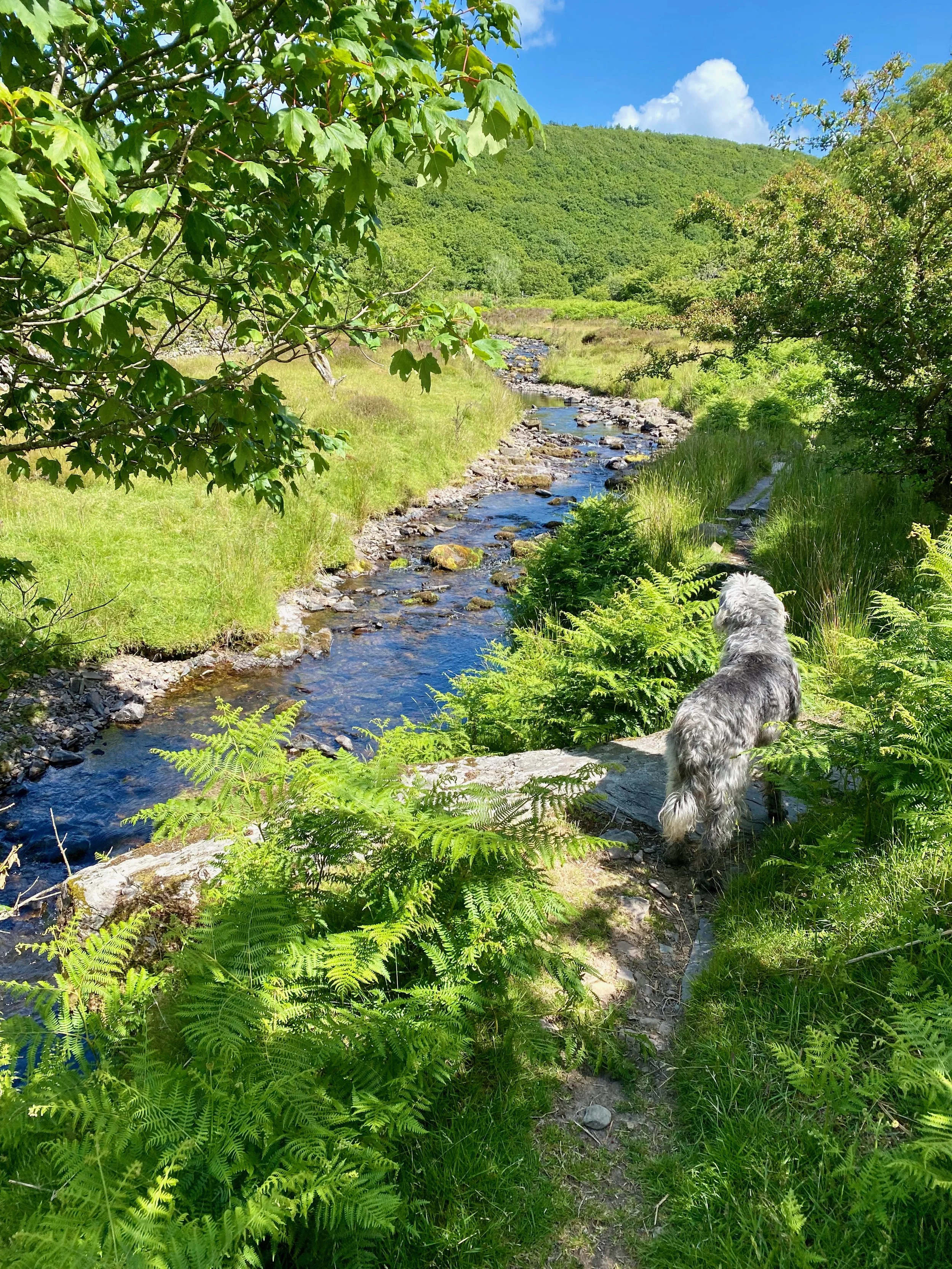
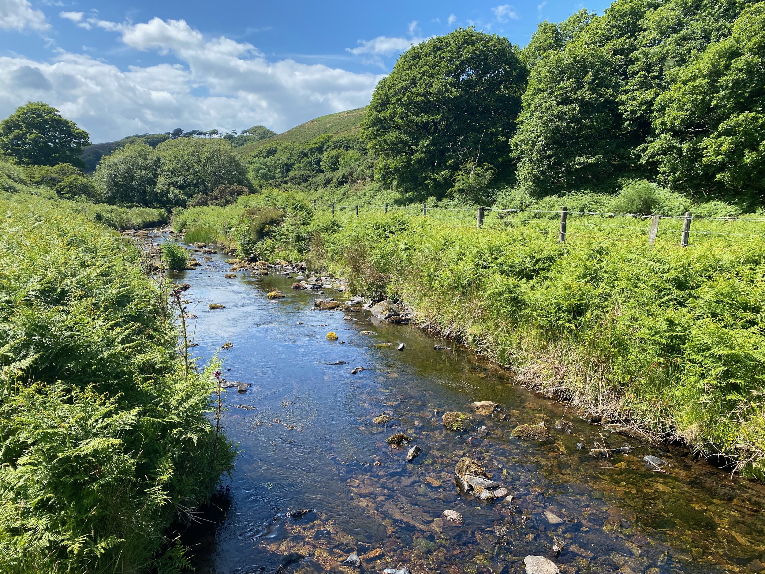
Weir Water, Exmoor
It isn't, although in the book Jan Ridd, hero of the famous tale, worked his way up the beautiful, haunting, stream tickling for trout when he was a boy.
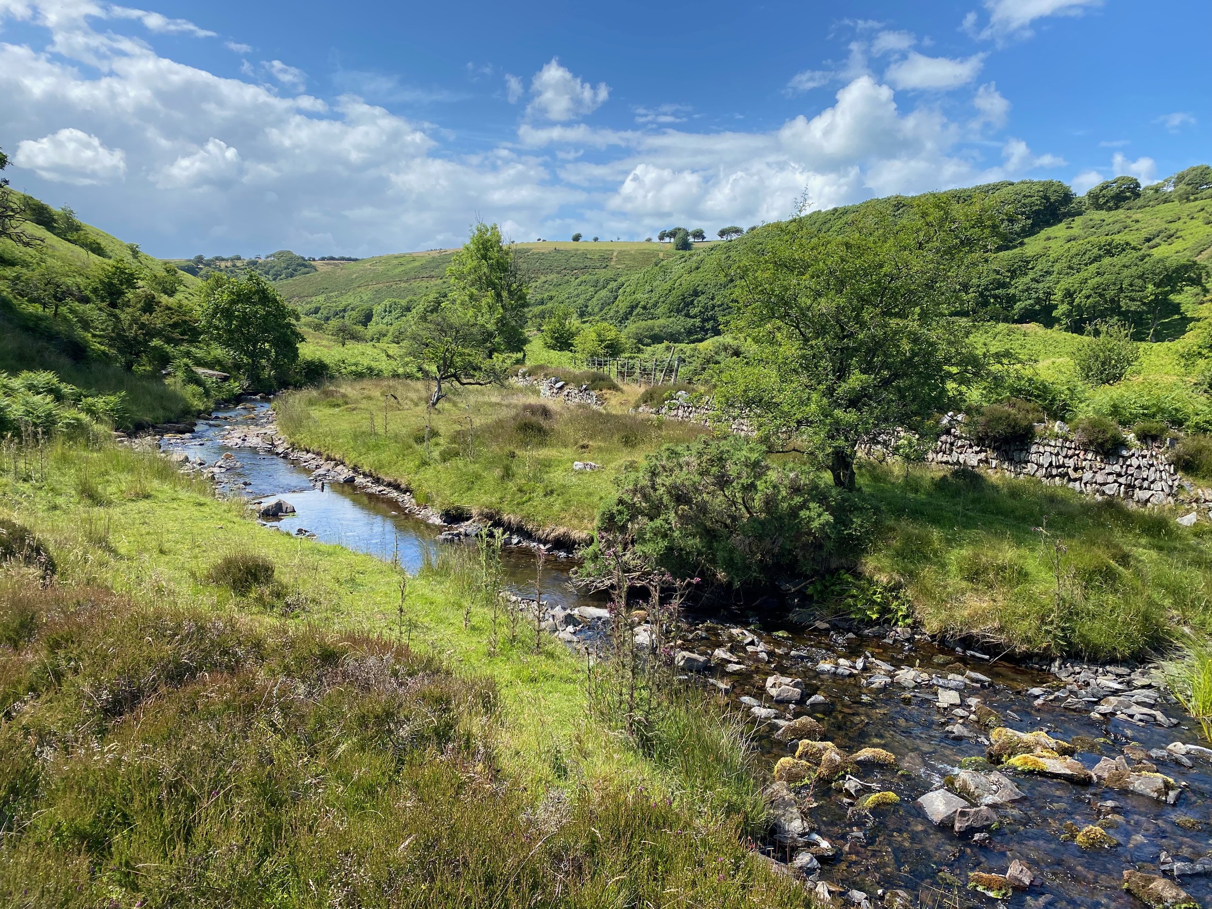
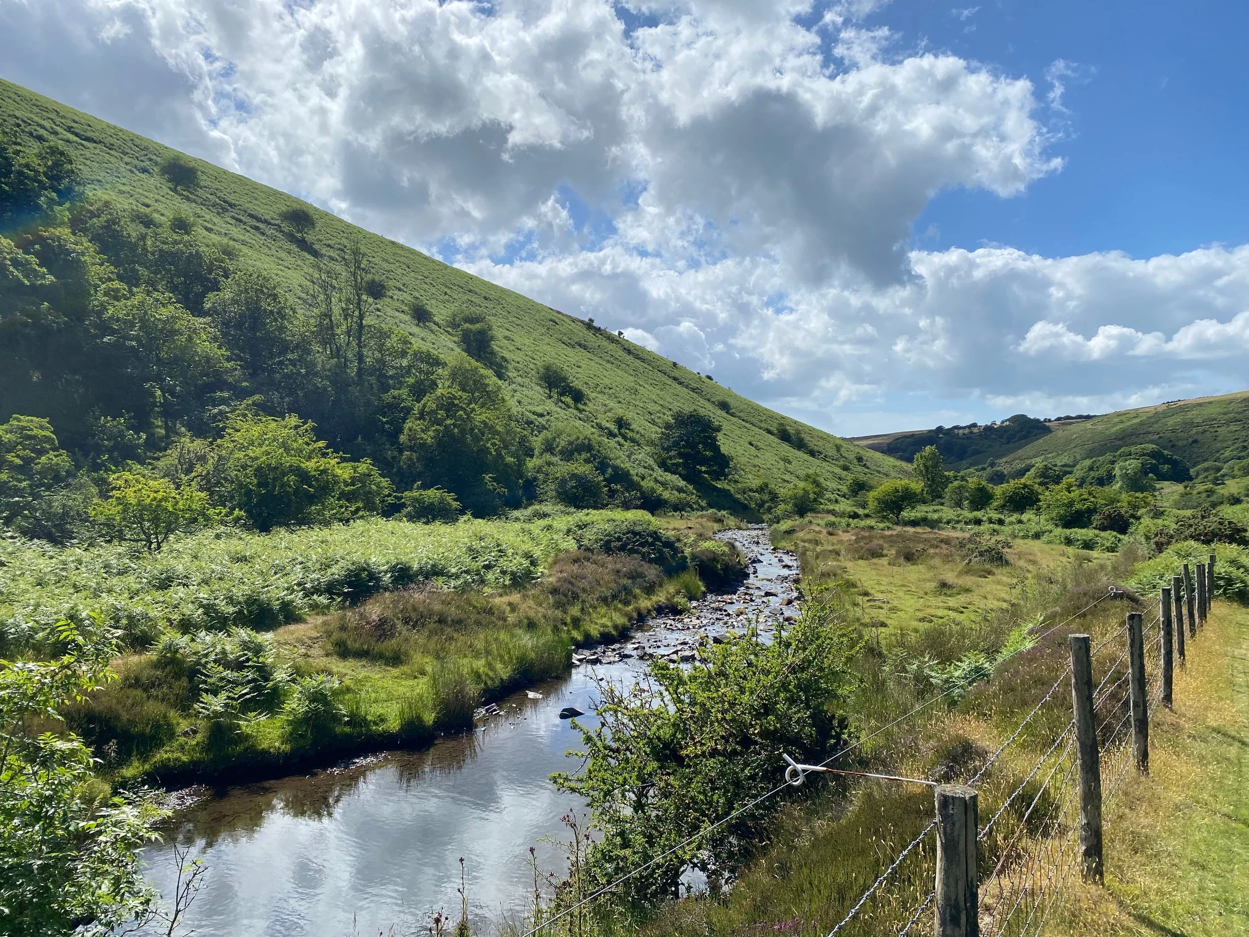
On a blue, cloudless autumn day, I can think of few places I'd rather be. It is the antithesis of industrialised Europe. The great wild steppe of high Exmoor curves down from Hawkcombe Head, Black Mires and Kittuck Moor and, high above, a solitary buzzard flits his great wings with a flash of westering light; a young, hindless, stag makes off towards featureless Outer Alscott and Jan Ridd's fingerlings flicker in the merry stream while a fat crop of fungi rots under the golden leaves of turning woods.
Things have changed a little bit since I used to come here as a child with my father, who was forever writing fanciful newspaper columns about the place. I can't imagine why he had nothing better to do but, judging by his cuttings file, the old boy was inordinately drawn to the Doones. He was forever quoting a man called Sir Atholl Oakley who had it in for the Ordnance Survey cartographers. They were the ones who insisted on calling the place the Doone Valley.
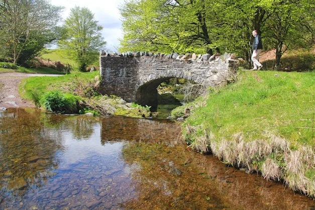
Robber’s Bridge
Sir Atholl obviously had his way in the end because Outdoor Leisure Map 9 has the correct appellation of Weir Water. And, as I say, there have been one or two other changes. Like, for instance, the barbed wire and the electric fence. For hundreds of years farmers got along without these brutal barriers - so why do they need the wretched things now? This valley, for some reason, has sprouted more than its fair share.
Another change is the "Circular Walk Around Weir Water". A small wooden sign points left as you stroll out of the car park near the bridge and I, for one, was in no mood to argue with it.
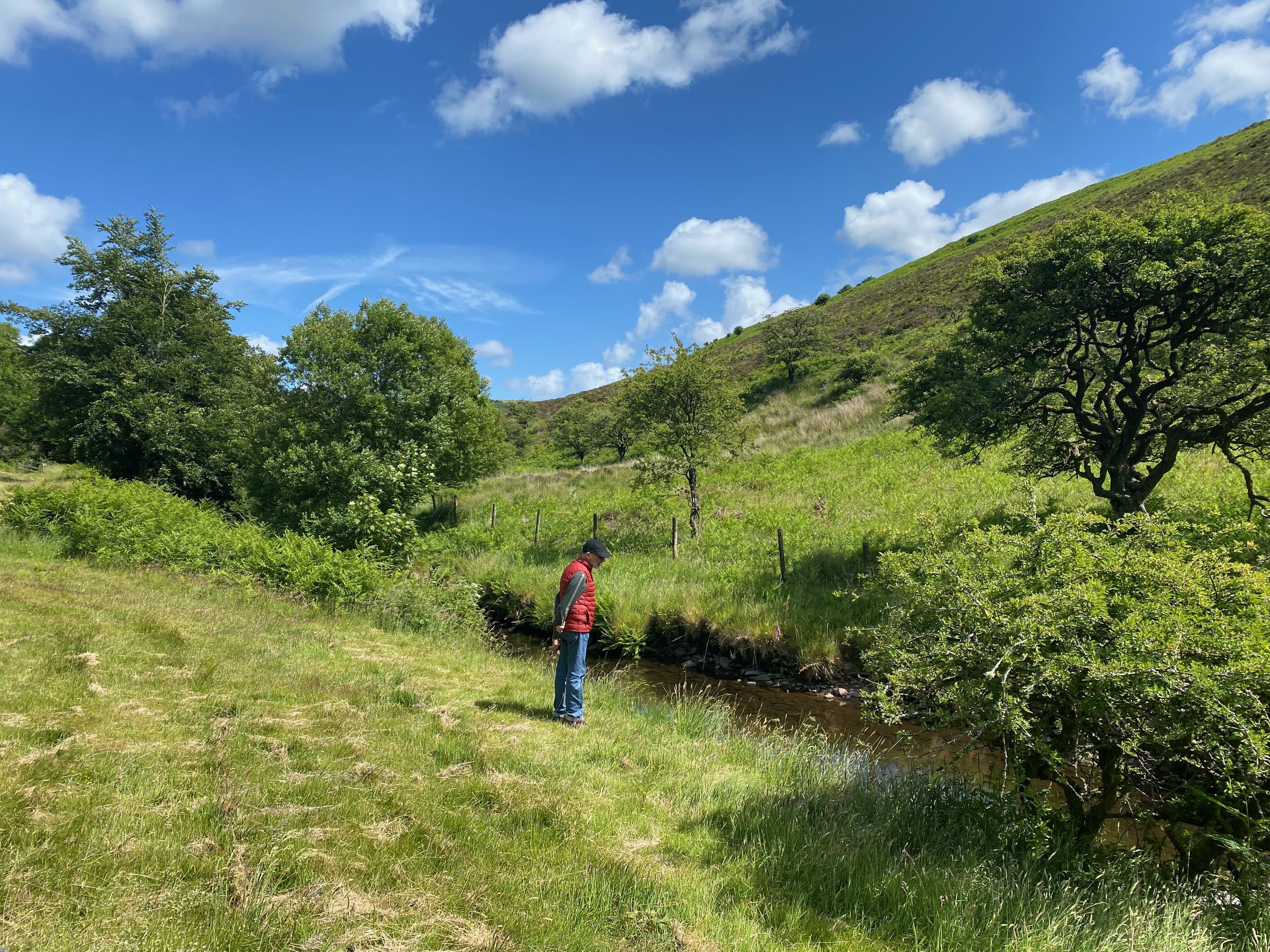
Last time I was up here I did a kind of double hike with a second loop in the other direction, once we'd regained Robber’s Bridge, but yesterday we were content to merely do the mile and a half up and around Weir Water.

We turned left out of the Robber's Bridge car park, found the circular trail and followed it up Weir Water. And very, very, lovely it was too.
If you want to walk further you can return to the bridge, find the steep bridleway that leads up to Culbone Inn, follow it, turn left and descend down Deddycombe to Oare. Then it's simply a matter of wandering back up the stream-side lane. That will give you a five mile figure-of-eight in one of the West Country's most picturesque corners - not bad for a weary walks writer who dreams of sleep and rest.
If it had been raining, I could have saved myself yet more trouble by quoting my old dad: "As we left the car at Robber's Bridge and began to walk up Weir Water, there were big, heart-broken rain clouds marching over Black Hill and pushing their shadows up the sunlit slopes of Weirwood Common in a most ominous fashion."
Would you believe the old boy wrote an entire column on the subject of getting wet. Journalists had it easy in those days...
At least it didn't rain on me - instead the sun belted down with force so that the weirs in Weir Water looked almost bathe-able. They say that's why it's called Weir Water by-the-way, because ridges of rock protrude into the stream at regular intervals causing it to pool into what is, in effect, a long flight of natural weirs.

To quote from The Waters of Exmoor, written by Noel Allen: “After its shallow start the Weir Water valley slowly deepens, the sides heather-hung for most of the way especially at this top end. The stream meanders from side to side with many of the loops marshy, and in a few places it has washed close enough under the valley sides to carve out brief sections of high rock walls. The bank sides or a mixture of heather, bracken, and grasses, with hawthorn and rowan the chief bushes, plus a good variety of moorland plants.
“The ring ouzel, wheatear, and whinchat all nest high in the valley, and also the rare merlin on occasions.”

Bridge at the top end of the Weir Water circular walk
The first thing you find on the circular route is a marvellous boardwalk which takes you dry-shod across a muddy section. Then we enter a magical zone where hillocky meadows melt into woods and where giant mushrooms can grow beside the path in season.
In once found a horse-mushroom here as big as a dinner plate - the great disc of the cap alone hit the scales at exactly one pound and it flavoured a wild mushroom risotto all by itself.
The circular route leads into the wildest depths of Weir Water, and then gives up, crosses the river and returns along the southern bank under the steep flanks of Mill Hill.

Recommended map: Exmoor Outdoor Leisure 9.


