Forest Walks in the South West - Part 2
Yesterday we featured five of my favourite forest or woodland walks in the region - today, being another scorcher, I am putting up the next five…
6 Frenchman’s Creek - Cornwall
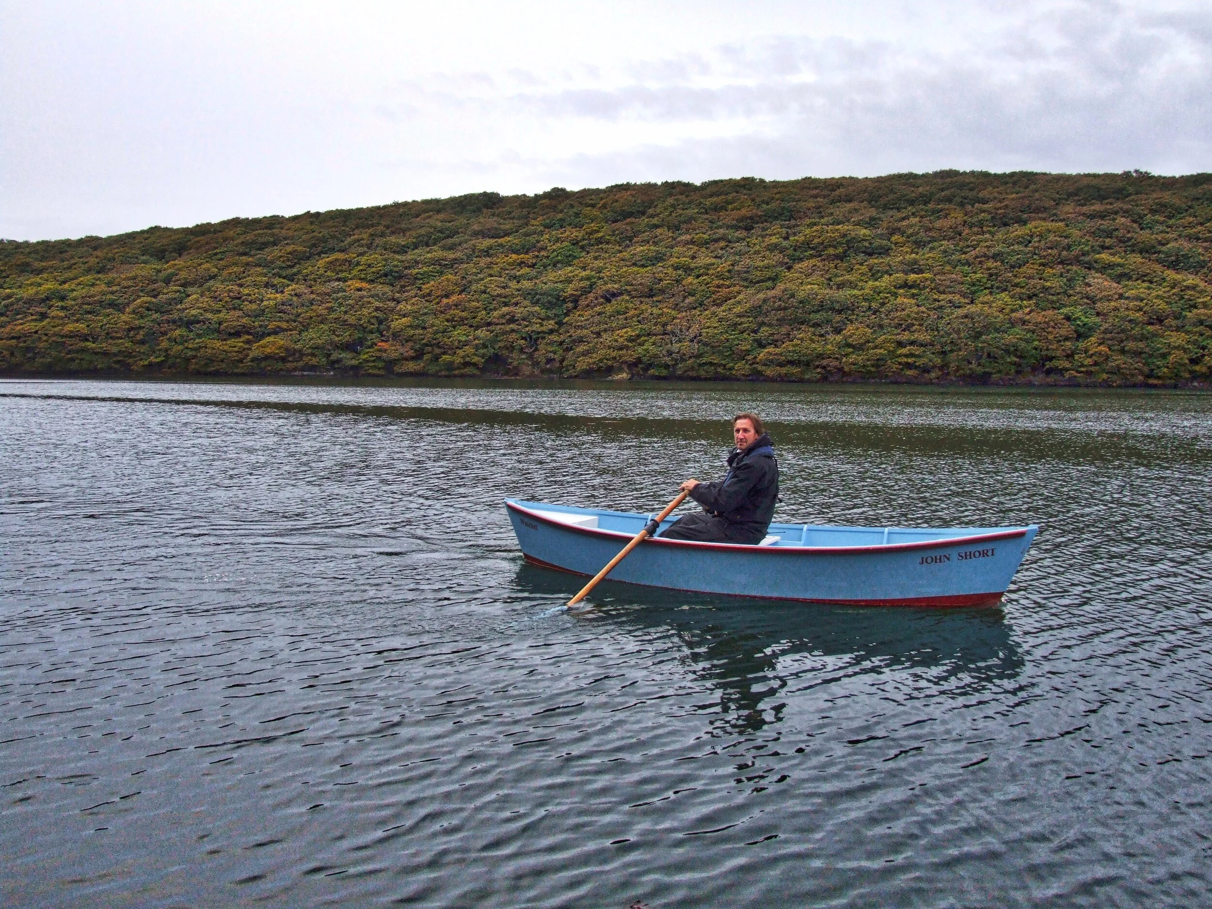
Martin rowing a Watchet Flatner near Frenchman’s Creek
Pure unabashed, unashamed romanticism, that's the theme of this hike. Frenchman's Creek has more of novel's atmosphere than any other literary waterside location.
If the tide is out the place literally oozes with the stuff of legend. If it's in then the shimmering tranquillity allows you to mentally plunge straight into the derring-deeds of Daphne du Maurier's brilliant tale.
I recommend taking the little foot-ferry that plies across from Helford Passage. There's something special about arriving at the beginning of a walk by boat and anyway, the hamlet on the north side of the river-mouth is a lot easier to get to than the alternative of negotiating the tortuous lanes of the Lizard peninsula.
It only takes a couple of minutes to cross to Helford. Du Maurier wrote: "Helford hamlet was no inducement to a sailor ashore, the few cottage folk dull-witted and uncommunicative..."
There's nothing dull-witted about the person who can afford one of those cottages now. A lane leads along the creek, past the pub and picturesque abodes, and eventually crosses a stream at a point close to where a footpath sign points to Manaccan. We take the track through the trees until a junction allows us to turn right into Under Wood and climb the hill towards the farm called Kestle which is an ancient farm full of character situated on the ridge of hill that divides Helford from Frenchman's Creek.
Walking through the old farmyard on the public footpath the thought struck me that Du Maurier’s description of walking to the creek fits exactly with the track that leads west from Kestle, down over the hill and into the trees:
"Yes, there once again was the glimmer of water that had surprised her. The trees were thinning, she was coming to the bank - and there, suddenly before her for the first time, was the creek, still and soundless, shrouded by the trees, hidden from the eyes of men."
The National Trust owns the woods that run from Frenchman's Pill up the eastern bank to the creek and its staff have laid a path along the waterside so that we can enjoy its hidden secret delights as long as we are willing to make the effort of walking there.
After half a mile or so the path departs from the waterside and hauls itself up the hill to meet what must be a drive to a hidden house. Turn right here and follow it up to a junction and take another right to follow the road another few hundred yards until you see a public footpath sign upon your left.
This takes you down through yet more Trust-owned property - again, deep and beautiful woods - until the right-of-way deposits you in quaint Penarvon Cove.
Now it's simply a matter of taking the track to the right which will lead you the quarter-mile or so back to the ferry landing-stage.
Distance: 2.5 miles. Time: Under 2 hours. Difficulty: 3/10
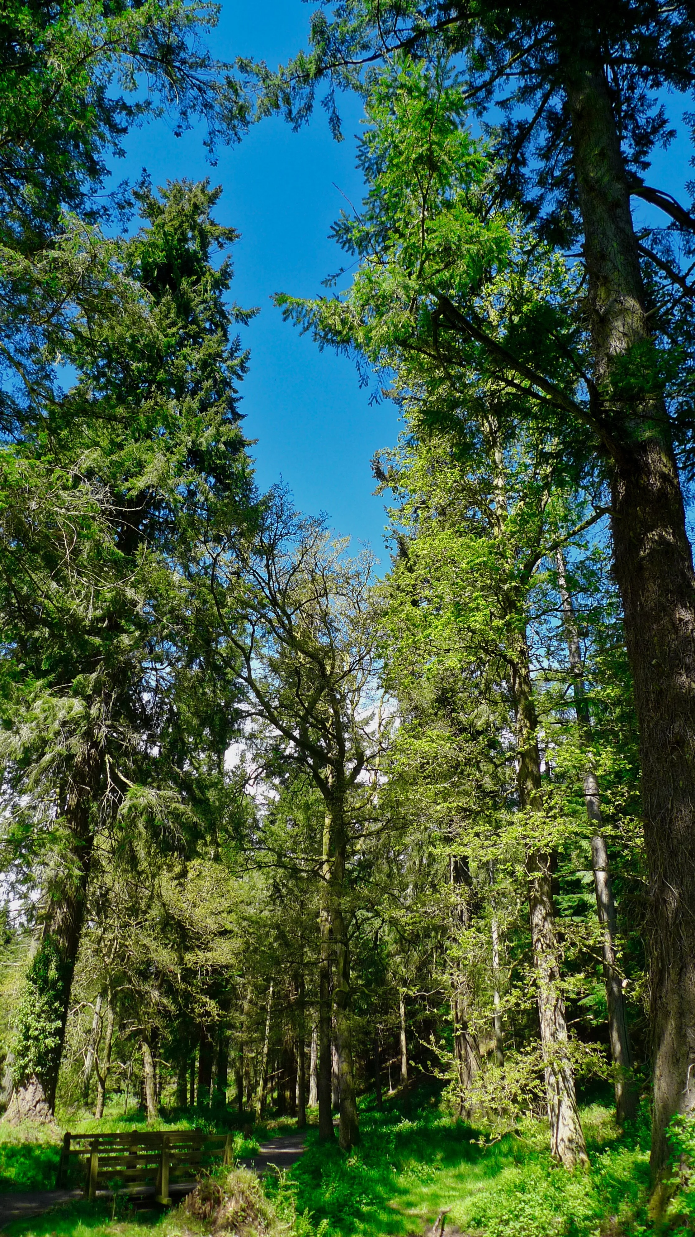
7 Lerryn to St Winnow circular

St Winnow part of the walk before you go back through the riverside woods
Another of my favourite wooded walks - and another which features Cornish creeks. There are rolling hills with panoramic views and there are the deep and silent woods which inspired a corner of one of the most famous books in children's literature. I am talking about the Wild Wood in Kenneth Grahame’s Wind in the Willows.
I begin by crossing the concrete stepping stones cross the creek at Lerryn - then it's up the lane opposite and left through a small housing estate to a public footpath which leads across the fields in front of a grand house called Ethy.
Now we enter Wild Wood. That's not it's real name but it really did inspire Grahame to write a chapter in his famous children’s book.
After a while you are out of the wood and into what can only be described as a sleepy hollow. Here it’s a matter of finding the path which will take you over the hills and fields to St Winnow.
There is a dream-like atmosphere about this heavenly hamlet which is perhaps propelled at you by the cry of a heron and the ghostly white flash of egret wings.
For the second half of the walk we enjoy what must be one of the loveliest riverside strolls anywhere in the West Country. There is not much you can say about this V-shaped route through the woods, which follows the Fowey south before turning north-east into the Lerryn Creek - except that it is a sylvan idyll.
The basic walk is just five miles in length - it is fairly level and not too muddy or slippery - and it is one of the very best in the region.
Distance: 5 miles. Time 3 hours. Difficulty 5/10
8 Croydon Hill - West Somerset

Croydon Hill woods above Luxborough on an altogether different sort of day weatherwise
Luxborough offers some of the best forested walking country in the South West. You are spoilt choice. The three-part community - consisting of Kingsbridge, Pooltown and Churchtown - is surrounded by forests and hills. But Kingsbridge (where the pub is) is as good a place as any to start and finish because there’s a car park situated nearby just beside the impressively large village hall.
I decided to go up through Chargot Wood so I could catch a glimpse of my old home. To do this I followed the lane due south from the hall to Pooltown and then swung right up the steep road that's marked Dunster. After about 400 metres a track descends left off the road, just opposite Hall Farm.
This leads down through some trees, over a stream, past an attractive cottage and then swings due west to ascend gently through some delightful meadows.
High above, to the north, on a shelf on the side of the hill, you'll see splendid old Chargot nestling beneath its giant cedar tree.
The track continues on into the deep coombe marked on the map as Chargot Wood. The thing to do is take the first forestry track on the right which turns back on itself to climb the slope westwards toward Collyhill Wood.
We are now high up on Kennisham Hill, and it's worth mentioning that this entire area was riddled with iron mines a century or more ago. You may have managed to catch a glimpse of an old chimney stack high above Chargot Wood - it's more-or-less the only obvious evidence left that any of this huge industry ever existed.
Lype Common lies just to the west of Kennisham and you'll notice that this area is criss-crossed with public rights of way. Here we can either head west to eventually hit the Heath Poult Cross and Timberscombe road, or descend due north to find the track that crosses directly to Luxborough's Churchtown. If you do the former, you're in for a longer walk - a truly enjoyable one that takes you down to the road, right for a hundred metres, and then down the footpath to Old Stowey, before turning east along the bottom of the valley, past Throat Cottages - to Westcott Farm.
We followed the right of way descending due north into the valley before making the short climb up to Churchtown. By turning left, or west, at the church we walked a few hundred yards up the lane to find the footpath that heads north across three fields to eventually arrive at a wide track. If we turn right here we can make the gentle climb to yet more vast pinewoods – this time we enter the great plantations which crown massive Croydon Hill.
This is an exciting and fruitful walking zone in its own right – you could spend a week hiking in and around Croydon Hill and never really have to take the same route twice.
On this occasion we are merely skirting its south eastern edge by striding up the higher flanks of Perley Coombe. Keep to your right all the time and after half an hour’s walking you will arrive at a crossroads of tracks on the edge of Withycombe Common.
Our walk requires us to turn sharp right at the crossroads and begin our descent down the eastern edge of Perley Coombe.
Down, down, down we go – once again on the border between pine-forest and fields – to eventually arrive at what used to be the Forestry Commission’s local headquarters. From here it’s simply a matter of walking 100 yards down the lane and turning right to stroll the last quarter of a mile back to the Kingsbridge part of Luxborough and the pub.
Distance - 8 miles. Time - 3.7 hours. Difficulty 7/10
9 Holford-Crowcombe - the Quantocks

This is a a linear hike that crosses the Quantock Hills from one side to the other. Which is not so difficult as some people might think because the Quantocks central ridge is long but thin - from one end to the other would be another matter.
You could easily walk the four miles from Holford, up Hodder’s Combe, over the Quantock ridge and down to Crowcombe, then return via alternative paths. But we were having lunch at the excellent Carew Arms, so did just the one-way jaunt.
In short, this walk is a delightful blend of hauntingly beautiful coombes best enjoyed with a sprinkling of literary banter (I’m referring to Coleridge and Wordsworth who often walked here), followed by lofty ridges with an Ancient Mariner's view of the sea, all washed down with a pint of best bitter in a cosy flag-stone floored English pub.
The hike starts at Holford, a village which is at the foot of one of the most beautiful wooded valley systems anywhere in England. It's easy to find both village green and car park and from here you simply head for the heights on the track to the right of the hill which divides two valleys. This is Hodder’s Combe, and up it you must go to the crest of the main Quantock ridge.
Up here you will be treated to enormous vistas before heading down hill towards lunch. To do this, turn left along the ridge track and follow it in the direction of Crowcombe Park Gate, but take a sharp right before you reach the metalled road. The idea is to get onto the footpath which descends around the northern limits to Crowcombe Park eventually entering the village near Grime’s Farm.
From there it’s just five minutes stroll to the Carew Arms, which happens to be one of my favourite pubs - although I admit to having quite a lengthy list of these.
Distance 4 miles. Time 3 hours. Difficulty 6/10
10 Lustleigh Cleave, Devon

The leafy perambulation around Lustleigh Cleave on the flanks of eastern Dartmoor is one of the finest walks to be enjoyed anywhere in Devon - and the thatched Cleave Inn, located at the centre of the pretty village of Lustleigh, is one of the best pubs I’ve visited in the county.
When it comes to alluring place-names, surely few locations in England can boast more seductive an appellation than the valley at Lustleigh Cleave. Author William Crossing described the place as, “One of the loveliest nooks in the whole of Devon.”
We are heading for Sharpitor which must be reached by ascending steeply through the woods just south of the hamlet of that name. The narrow track is clearly marked and passes between two gardens before issuing out into the trees.
After the climb we are introduced to the spectacular, gaping abyss of Lustleigh Cleave. We can stand on a rock called the Nut Crackers and admire at the vastness of the great rift and see Houndtor Wood just opposite, curving up its steep coombe to Becka Falls. Higher still there’s lonely Manaton guarding its distant marches.
As we proceed north-west along the edge of Lustleigh Cleave, so the views between the trees open up to reveal the mysterious and complex flanks of Dartmoor's north-eastern territory. The rocks at Harton Chest make the most glorious picnic spot I know.
Further north-west we come to Hunter's Tor - a massive collection of granite bed-rock and boulders that dominates the corner of this spur of hill.
Now we bid farewell to sweeping views and descend by taking the footpath past Peck Farm and swing left down under Hunter's Tor to Foxworthy. Here we find the bridleway that weaves its way through woods under the ramparts of the Cleave. Just below the Nut Crackers there's a chance to turn right downhill, and this path swings around to join a track to Pethybridge.
Now we simply find the footpath that curves around the little hill, through the wood and onto the tiny lane that leads back down to Lustleigh and its community orchard.
Distance 6 miles. Time 4 hours. Difficulty 7/10

Enjoying a post-walk pint and lunch with Lustleigh pub landlord and Otter Brewery’s Patrick McCaig