

Forest Walks in the South West
“If we sing of the woods, let them be woods of consular dignity,” wrote the poet Virgil in ancient times.
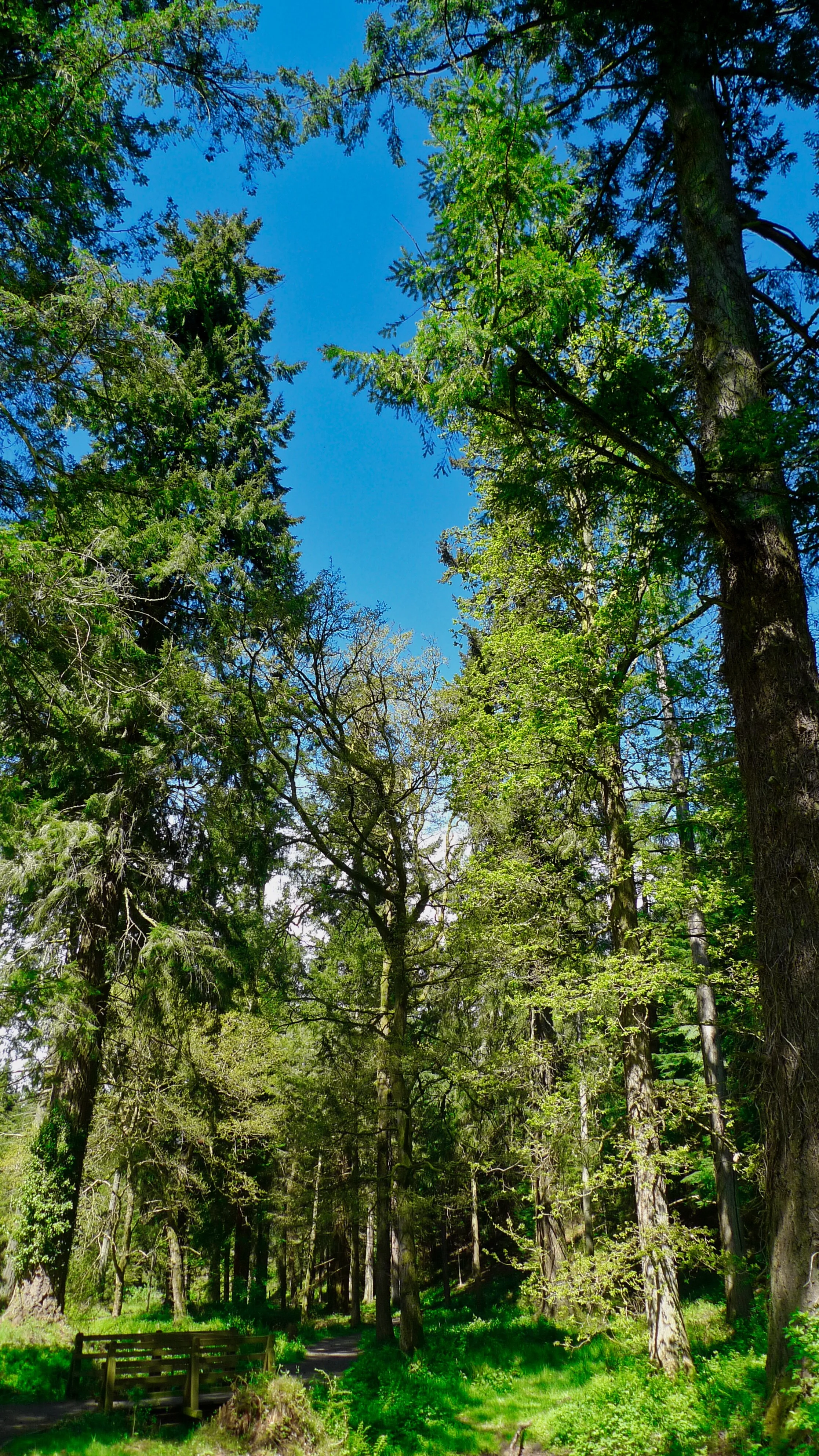
I’ve never really understood what that means, but this region’s woodlands retain wondrous amounts dignity, consular or otherwise. Which is one reason I like walking in them so much. And today it’s hot. Tomorrow is meant to be even hotter - so walking in a cool forest could be a good plan…

Trees are good friends to mankind in all manner of ways. We can make things out of their wood and they provide a fabulous habitat for all manner of plants and creatures. They also act as a valuable carbon sink in these times when humankind seems so hell bent on wrecking the planet with our love of cars, consumerism, convenience and easy indoor living.
But these things come at a price - and I’m not just talking about the planet’s atmosphere. Humans were not really designed to live in the modern rat race or in vast cities made of concrete - and trees, or forests, offer a kind of gentle salve or cure.
Research studies carried out in many countries over the past decade have show that when people walk or spend time in forests, they relax, calm down and generally chill out - all of which can conjure better health. Some countries like South Korea are now planting large forests in and around large cities to afford their hard working populations a natural way to tune their ravaged souls and feel better about life.
Here in the West Country we have a great many forests, copses and woodlands. And we have the excellent Forestry Commission which owns and manages large tracts of land across the peninsula. And the good news about the FC is that it has changed the way it plants trees down the years - no longer do they cover massive acreages with big black forests of endless, lifeless, conifers. Carefully selected mixed planting which incorporates many indigenous species is more the order of the day - which makes such forests far more pleasant to walk in.
Also the Forestry Commission welcomes walkers to stroll its many tracks and rides unless, of course, large scale clearance operations are underway - which they happen to be in several of my favourite forests at the moment.

The other things about forests and woodlands is that they can offer wonderful shelter belts for walkers to enjoy at this time of year when midwinter storms are raging through.
I can remember one day in particular a few years ago when I was intending to do a walk on Dartmoor and the wind and rain were so savage my car was swaying from side to side as I drove past lonely Warren Inn. A few miles later I pulled into Bellever Forest and enjoyed an hour-long hike in the most gentle of conditions. I could hear the gale booming in the distant outer trees, but where I was in the heart of the forest you could have dropped a feather and it would have landed at your feet.
Walking is an important form of exercise for those of us who do not play regular sport or go to the gym - which is why its a good idea to keep putting one foot in front of another even in winter. A recent Natural England survey found that a massive 57 per cent of people said a walk or a ramble was the main activity enjoyed on any kind of outdoor leisure visit they made.
“It’s been shown that the great outdoors is the best motivator to keep people walking and active,” said a Natural England spokesman. “It’s also the easiest form of exercise to make part of your daily routine and the significant effect it can have on reducing or coping with stress really can make a difference to peoples’ lives.”
Exercising outside can improve concentration for several hours afterwards and makes you more resilient to stress or helps cope with stress. Walking protects our joints from wear and tear thanks to muscle build-up - and it improves your immune system for up to 24 hours after a walk which can help prevent you from catching a cold.
If you walk for 30 minutes a day you can burn off 2,000 calories a week (the equivalent of six Mars bars) or 150 calories per mile. That may not seem like a lot but walking and keeping fit also increases your metabolism, so it’s good for you even when you’re not doing it.

As I’ve mentioned above, research shows that our stress levels fall within minutes of contact with nature – good for body and mind
And walking crosses all generations so everyone can get involved. Research has shown that if children haven’t had the opportunity to be in the natural environmental on their own before the age of 11, they’re unlikely to use the great outdoors in later life and therefore benefit from the stress relieving qualities the outdoors can bring.
So - taking this dual theme of walking and forests - I put together a list of some of the best woodland hikes in the South West for you to enjoy. I’m not claiming that every step of every walk will be surrounded by trees - some are but others will include copses, woods or forests along the way.
Here’s the first 5 - will put the second 5 up tomorrow, and so on…

Track above Weacombe on The Quantocks
1 Bicknoller-Weacombe Circular - the Quantock Hills
This is an example of a walk which includes woodlands, but which also features high ridges and moors. A variety which makes it one of the best short walks in the region. The basic hike, set in the north Quantocks, starts at Bicknoller and runs along the fringe of the moor to Weacombe, then turns up that valley to Bicknoller Post before returning down Bicknoller Coombe.
At Bicknoller you might be best advised to park down in the car park down by the village hall because there’s not much room in the lane that leads up to the coombe.
Walked up to the entrance of the valley and, before entering its hallowed confines, turn left and take the footpath that fringes the hills as it heads for Weacombe. This is a particularly pleasing part of the jaunt as it affords sublime views of the Vale of West Somerset.
Weacombe announces itself with the dramatic abruptness that is typical in hills carved out of soft red sandstone. The tiny stream has had a relatively easy job of it over the years, and now the coombe is deep and steep.
We turn right into it and proceed up the stream-side to enter the bosom of the hills… Up and up Weacombe goes, to eventually fork at its upper end. We take the right hand path and climb to Bicknoller Post. There is, indeed, a post there to announce the fact…
It marks the watershed junction between Weacombe to the west of the ridge and the Holford complex of coombes to the east – curiously, the head of Bicknoller Coombe is another mile to the south.
here we are on the main ridge of the Quantock Hills - which boasts some of the best 360-degree panoramas you will find anywhere. We walk along it for a while, keeping right when it comes to the assortment tracks which would take us further along the ridge. What we’re looking for is the next big groove that falls away from the hills to our right – for this is secret Bicknoller Coombe.
And all we have to do is walk down it to find the place where we started – or, better still, to continue on into Bicknoller where there is an excellent pub to hand.
Distance: 4 miles. Time: 2.5 hours. Difficulty: 4/10.

Bellever and its Tor on Dartmoor
2 Bellever Tor Circular - Dartmoor
The great thing about this short walk is that the exercise you get by climbing Dartmoor’s most central tor is richly rewarded by fabulous panoramas from the top.
Park at the small car park on the Two Bridges-Moretonhampstead road at Higher Cherrybrook Bridge. From here a track ascends gently to the east. After a few hundred yards it enters the forest, where it’s simply a matter of continuing east until you come across a wide, deforested swathe of land that sweeps southward to Bellever Tor.
It’s one of the only tors which offers views exclusive to the national park. In other words, Dartmoor is all you see. That’s because Bellever is situated plonk in the middle of the national park’s central plateau and you cannot peer beyond the edges to the larger world beyond.
People have been living in or visiting this area for a long, long time - the whole area is rich in archaeological remains such as cairns, cists and old field systems.
To complete the walk, descend due east of the tor to re-enter the forest at a point where a small path threads its way down the hillside to eventually join one of the Forest Enterprise tracks. Following this north along the contour, continue until you reach Kraps Ring – the remains of an ancient settlement at the opposite end of the clear-felled swathe to Bellever Tor - then simply return west along the forestry tracks to Cherrybrook Bridge.
Distance 3 miles, Time 1.5 hours, Difficultry 2/10

Ashclyst signs
3 Ashclyst Forest - Central Devon
From our earliest age we are made aware of big dark forests – they are fairytale places where big bad wolves live and where we humans get horribly lost. Novice hikers might be tempted to take a bag full of white pebbles with them, like Hansel and Gretel.
Far be it from us to suggest readers deposit any kind of object into one of our environmentally immaculate forests. Instead, let’s go to Ashclyst Forest – one of the largest tracts of ancient woodland in the region – situated not in the back end of ancient beyond but just a short witch’s broom-ride from the M5. It is rich in way marked walks and it should be impossible to get lost.
Ashclyst is not only easy to reach, but hugely enjoyable - having been well preserved by its owner the National Trust. There are several car parks but the main one, situated at OS grid ref SY 001995, has an interpretation board showing the various way-marked trails which vary from 1.5 miles to a total of seven miles in length.
The board also gives a brief potted history of the forest, which is interesting because you get the distinct feeling that up here - out of earshot of the modern world - this is how much of England used to be.
We recommend the Trust’s Butterfly Walk - leisurely stroll along sunken lanes and woodland rides and through broad-leaved and coniferous woodland, good for fritillary butterflies, white admiral and other butterflies. It can be a bit muddy in winter on this clay ground - for directions see the interpretation board or visit www.nationaltrust.org.uk/killerton.
Distance: 4 miles. Time: 3.5 hours. Difficulty (when wet) 6/10

Heddon’s Cleave
4 Heddon’s Mouth Woody Bay circular - Exmoor Coast
Another hike that passes thought woodlands but which also features a wild, rugged and extremely scenic coast. This walk always features in my Top Ten of Wonderful West Country Walks.
The perpendicular plod which meanders from Heddon's Mouth to Woody Bay and back again would certainly be up there among the best-sellers. It boasts views by the vista-load, history by the ancient, dusty, book-full and enough solitude to wither a lonesome pine.
The first part of this hike is down Heddon's Mouth Cleave - which really is one of the steepest, deepest valleys to be found anywhere in the West Country. It runs straight out of the depths of Exmoor down to the sea, and the fact that there's an excellent hostelry deep the bottom of the great gulch is almost thrown into insignificance by the grandeur of it all.
You can park near the pub in the small car park opposite the National Trust visitor centre which will tell you all about the remarkable terrain. Then, walk past the inn (you will need refreshment on your return) and follow the road around the bottom of the valley towards Trentishoe. After a quarter of a mile you will see the footpath leading to the beach on your right.
It's a riverside mile down to the sea - one of the most dramatic miles in England. In 1827 a local farmer called Jim Hoyle was caught with no fewer than £1,180's worth of brandy hidden under his stable floors. Customs and Excise confiscated the 262 tubs of booze, but lucky Jim escaped through a back window.
And now we cross the river to find the coast path which heads in an easterly direction - albeit vertically - out of the valley and along the coast on a section of the right of way which is not for those who suffer vertigo. Eventually there's a climb through the woods towards the upper section of the scattered community of Woody Bay.
Many of the paths around here were put in place by James Hannington, a local curate, and after that an African bishop - who found himself 'rusticated' from Oxford and forced to learn the duties of his calling at nearby Martinhoe. You'll see this rugged little hamlet across a few fields later, but you won't see poor old Hannington who was eventually done to death by irreligious natives deep in the Dark Continent.
Eventually we reach the old carriageway near Woody Bay, where we turn right back towards Heddon's Mouth to enjoy the breathtaking views that sweep across the Bristol Channel.
The dramatic headlands which punctuate Exmoor's vertical coast fall over themselves in a queue as they enthusiastically line up to show just who's best at being jagged and dangerous.
There's Crock Point, Duty Point, Hollerday Hill above Lynton and Lynmouth and, of course the North Devon Foreland with its lighthouse blinking intermittently above the grey sea.
Along the way we pass the remains of the Roman signal-station in which Italian soldiers must have once frozen on guard-duty. After that the track turns into the massive Cleave and takes you dramatically back to Hunters Inn.
Distance: 6 miles. Time: 4 hours. Difficulty: 6/10 - Fernworthy Reservoir Circular

Fernworthy wildlife protection zone
5 Fernworthy Reservoir Circular - Dartmoor
Another Forestry Commission treat, way, way up in the moors. To find the three-and-a-half-mile walk that circumnavigates this reservoir high on Dartmoor you can either follow the brown road signs up into the hills from Chagford, or follow the signs from the Moretonhampstead-Princeton road. Either way is narrow and full of bends. But don’t be put off – Fernworthy is a wonderful place to visit – both in a watery and an arboreal sense.
There’s a visitor car park and a scenic picnic area for those who simply wish to stop and admire the reservoir and the magnificent forests – or there’s a choice of hikes for those who fancy some exercise. The round-the-lake walk is probably easiest and most desirable.
There seems little point in setting out directions here: a) because a large illustrated map adorns the interpretation board by the car park, and b) because the route around the lake is obvious. The only difficulty is in making up your mind as to whether you should walk clockwise or anti-clockwise.
Having looked at Fernworthy on the map, you could assume that the walk would be an unbroken belt of dark conifers. You’d be wrong. After a brief walk through the dark trees you soon find yourself on the other side of the gloom and walking across what used to be ancient fields belonging to the three farms that once made a living up here.
Indigenous scrub trees line the way and looked most colourful on the day when we did the walk.
It was in 1942 that Torbay council built Fernworthy Reservoir. There’s a plaque by the dam which tells you all about the wartime opening ceremony.
There’s a boardwalk that skirts through the trees to the western end of the forest.
The wooden way eventually ends in moorland – and now we were on the western shore of the lake. As the reservoir narrows towards the dam you can look across at the remains of a Bronze Age hut encampment on the far bank.
Eventually the path descends under the dry side of the dam. Unlike some of the region’s larger reservoirs, Fernworthy doesn’t have a dam that you can cross.
The path winds its way down through a jungle of rhododendron before crossing the river and climbing sharply up the other side. Here we turn right and walk a quarter of a mile or so to regain the car park.
What more could you ask for? A lakeside walk complete with forests and moorland views - plus the novelty of historic sights you may never see again.
Distance: 3.5 miles. Time: 1.4hours. Difficulty: 2/10

