Celebrated Cornwall: Delights of the Camel Trail
The other days I came across an old video we made about cycling down the Camel Trail, which you can see here. I also wrote this article about the cycling adventure…
Sometimes the greatest journeys are ones where you and you alone earn all the glory. Foot-slogging, Shank’s Pony, stomping, striding, pedalling, call it what you will – it’s your own muscle power that takes you from A to glorious B that does that trick and resulting in a sense of satisfaction that can make you prouder than anything a ride in a machine can offer.
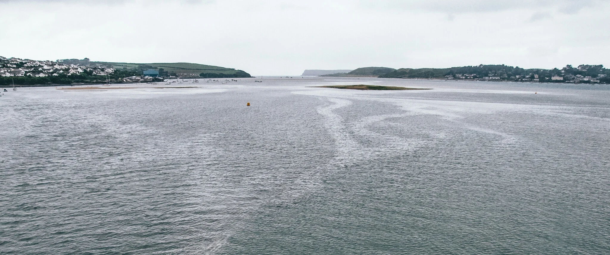
The Camel Estuary on a dark rainy day from the Camel Trail
I suppose bicycles are machines, but you know what I mean. Cycle the length of the Camel Trail, and back, and you won’t regard your two wheels as offering much of an advantage. Depending on your level of fitness, your muscles will be complaining of their state of weariness somewhere along the journey – and next day they’ll be lining up big time to remind you that perhaps your aren’t the youthful age you thought you were.

Old rail bridge carries the Camel Trail across a side-creek
Mine were reporting for pain and sympathy last week – especially in the unmentionable areas that surround a bicycle’s saddle. Running and walking is what I do to keep fit – I now know that cycling requires a different kit of parts altogether.
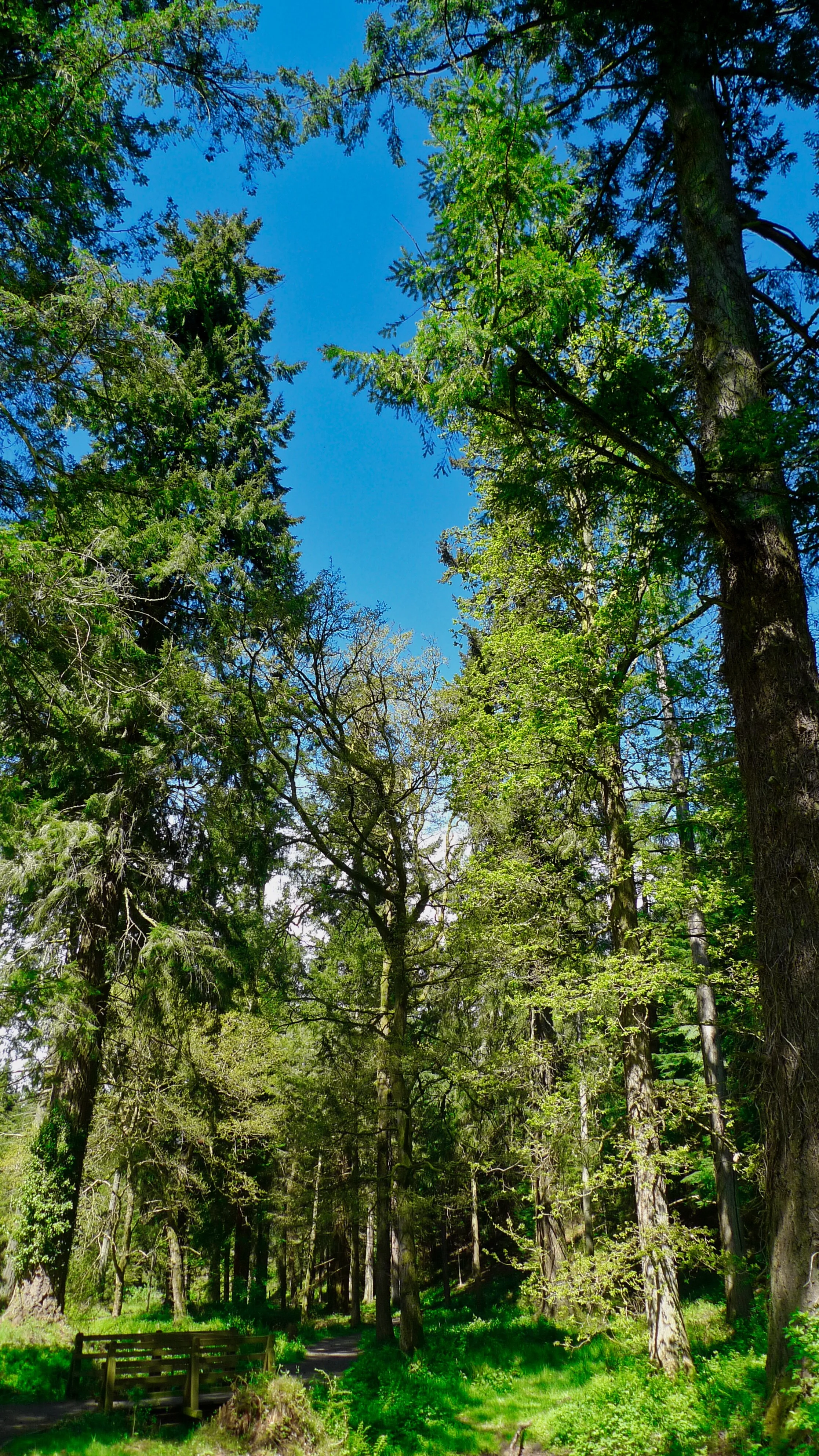
Not that any of this discomfort in the least bit detracted from the pure joy of the Camel Trail. The 18 miles of disused railway track offers one of the best days out in the region. That's no exaggeration. The trail follows the River Camel faithfully as it meanders through some of the finest countryside to be found in the county of Cornwall.
Indeed, the Camel Valley belies the incorrect adage which claims all that is best in Cornwall is to be found within 100 yards of the sea.
We began our journey at Poley's Bridge, close to the village of St Breward, but the trail has been extended north a bit to Wenfordbridge through the old China clay dries – thanks to the generosity of Imerys which owns the land.
The area is a surprisingly remote and lonely part of the Camel Valley halfway between Camelford and Bodmin. From here the trail runs south, then west through Wadebridge, to follow the ever widening estuary to Padstow. It is excellently maintained and, believe me, is a pure joy to peddle. We did the whole trip - down to the sea and back up again - in one day and despite the muscle ache, rain, wind and the disappointment of finding Rick Stein’s fish and chip shop closed for the afternoon, I'd recommend the experience to anyone.
The trail runs along the track of an old railway line which was first proposed by Sir William Molesworth of Pencarrow in 1832. The Wadebridge to Bodmin railway was built to convey the lime-rich sea sand from the Camel estuary to the bleak and infertile farms up in the hills. Construction started straight away and on the 4th July 1834 the line was opened.

Believe it or not, it was the world’s third working railway- after the Stockton to Darlington and the Liverpool to Manchester lines. So you are certainly cycling along history.
By 1846 the rail network in the region had been extended and the line was purchased by the London and South Western Railway. Later, in 1899, it was extended to Padstow so that passengers could reach the seaside from the main line at Bodmin.
During the Plymouth blitz, trains used the Bodmin-Boscarne-Wadebridge link lines to travel over the North Cornwall line to Exeter and beyond.
As you begin to cycle down the heavenly valley, happy historic thoughts fill your mind. “How civilised,” you think. “How very sophisticated to have such a fantastic network of hugely efficient public transport. Wouldn’t such a thing help to alleviate our massive carbon footprint? If we had such networks everywhere we could truly be said to be combating global warming…”
Alas such thoughts did not occur to anyone in 1967. On 28th January of that year passenger services between Padstow and Bodmin Road ended after 132 years – chopped by the Beeching Axe.
Talking of executions, grizzly hangings at Bodmin Gaol used to see the line at its busiest. For instance, when brothers William and James Lightfoot were hanged for the murder of Neville Norway on 13th April 1840, special excursion trains were laid on and stopped outside the Gaol. From the windows of the trains, passengers would have been able to see the murderers swinging.
And talking of swinging, there were some kids leaping from a Tarzan swing at a place called Crabb's Pool, when we cycled by on our way to Bodmin. Jolly good fun it looked too, as they plunged into the murky depths of the river. Too cold for me though. The river is not exactly warm as it has flowed through miles and miles of woodlands to reach this spot. Beautiful mixed woodlands, which have an air of timeless peace and quiet about them.
Along these sections you really do see deepest Cornwall at its best, but there's more to come after we pass Boscarne Junction and head for the tidal reaches of the magnificent River Camel.
It’s at Boscarne Junction that the steam trains of the Bodmin and Wenford Railway are shunted from one end of the train to the other so that they can return up the hill to town.
For the whole of its early course the Camel flows in a southerly direction as if making for Land’s End, but suddenly it changes its mind to veer north-west. And the change marks an adjustment in the way the river looks.
Not long after Boscarne Junction it changes flavour in a subtle sort of way – up until now it has been a wooded and bosky affair with the occasional rapid and pool. Now it begins to runs through a series of miniature wetlands. Reed beds do their best to hide the stream and all of a sudden as you cycle along, you realise that the Camel has become estuarine.
On our return journey were able to see just how fast the incoming tide can flow - at about the same speed as I was pedalling - but it was difficult to tell exactly where the freshwater and saltwater zones have their birder. Somewhere around where the River Ruthern enters from the south, under Great Grogley Downs, I think.
What doesn’t change – yet, at least – is the way the Camel keeps to its modest-sized valley. The embracing of saltwater isn’t welcomed by some huge sea-facing vale as it is with quite a few West Country estuaries, the river squeezes through the hills as if keeping its whereabouts secret from the rest of the world.
Nevertheless, it is all part of the Special Area of Conservation (SAC) under the EC Species and Habitats Directive. Sounds important – and it is, because not many areas in Britain get that international accolade. A local fisheries officer once told me that the humble bullhead fish, along with the otter, were the primary reasons for the river system receiving the designation.
“Freshwater fish species recorded within the Camel include Atlantic salmon, sea trout, brown trout, bullhead, juvenile lamprey and eel,” he said. “There are also small populations of three-spined stickleback, minnow and stone loach. In some years sea lamprey have been recorded spawning within the lower reaches of the river Camel (between late May and July). We would always be interested in sightings of this relatively uncommon species.”
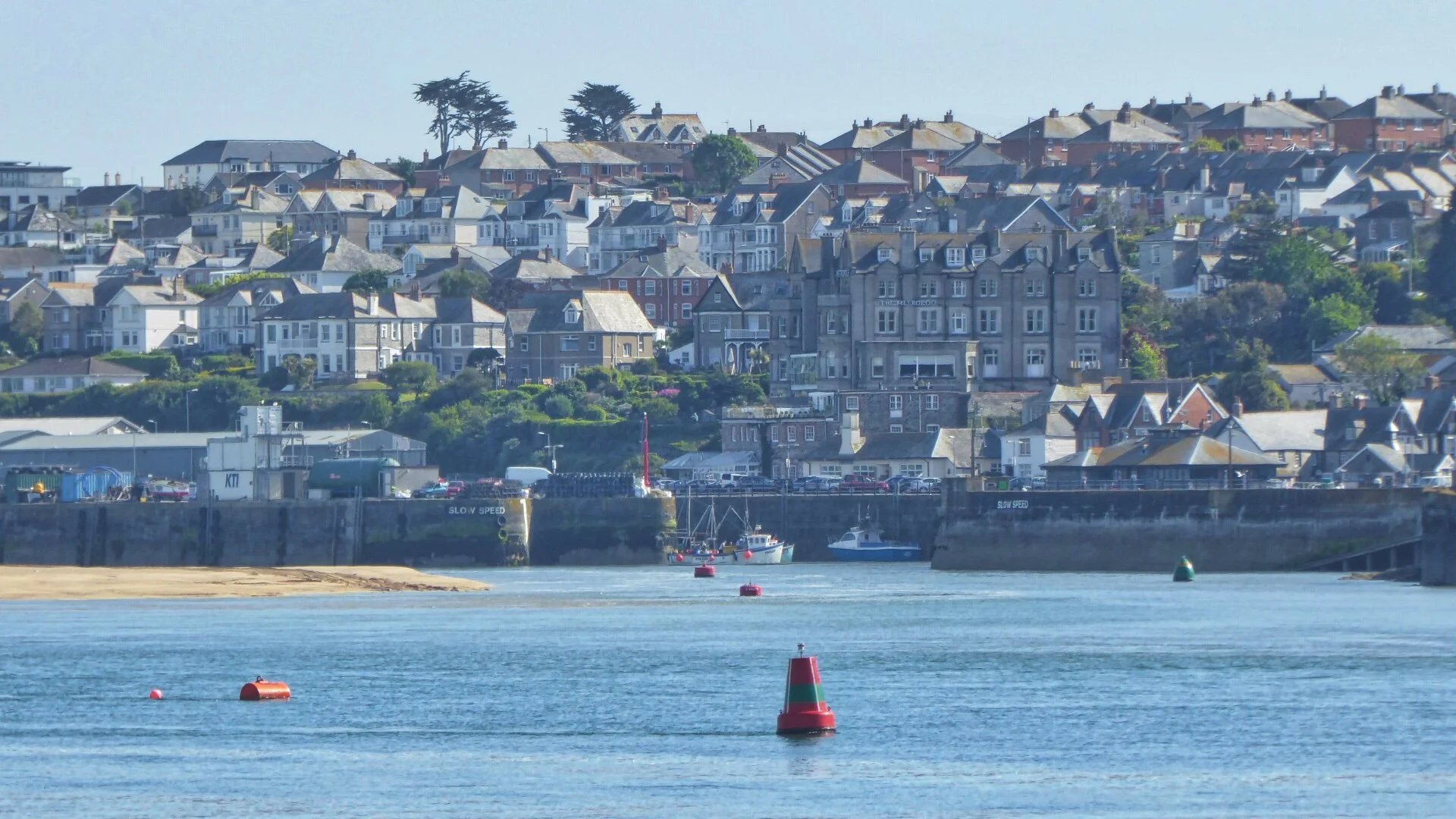
The lower reaches are where my bicycle journey took me next - after I'd negotiated the busy streets of Wadebridge. I say busy, but things aren't nearly as bad as they used to be before the big A39 bypass put a huge road bridge across the river on the sea side of town. Before that everything used to come over the ancient, narrow, multi-arched bridge and the traffic used to tail back for miles.
It’s a pity, though, that more hasn’t been done to protect the estimated 400,000 users who cycle the trail (or part of it) each year. That is an impressive number of people – and they spend an estimated £3 million locally per annum – so the fact they are allocated a mere foot-wide strip along the side of Wadebridge’s busy roads seems a bit mean. Given that whopping annual spend, I am sure something could be done along the riverbank to keep the cyclists safe.
Past the pubs, supermarkets, restaurants and traffic, we are suddenly peaceful and free from peril again. Cycling under the huge span of the A39 you can see how the valley does widens dramatically to create a vast estuarine landscape.

An officer for the Environment Agency once told me: “The Camel is a prime site of nature conservation value in Cornwall. It contains the largest and most sheltered inlet on the north Cornwall coast and includes a diverse range of habitat types.
“Much of the site is occupied by extensive sand bars and mudflats which support little vegetation, but which, together with the extensive areas of salt-marsh, are very important for birdlife. This is one of the best sites for birds in the county: the site is of national importance for golden plover. The numbers of wigeon, curlew, dunlin and lapwing are also of note.”
You can spot all of these and more as you pedal down the seven miles of ex-railway track to Padstow. It is as beautiful an estuary as any in the country - made all the better for the fact that no road comes near. A couple of tiny lanes do creep down to the southern shore, but they stop abruptly and do not run alongside the old line nor interfere with it. Which is exactly the way cycle trails should be.

As we approach Padstow we can look across at Rock - which isn't in the least bit rocky at all but entirely sandy instead. Dunes dominate the northern shore of the estuary at this point, and effectively hide lovely old St Enedoc Church where John Betjeman lies buried. I can never think of the place without recalling these nostalgic lines of childhood seaside joy, from his poem called 'Trebetherick':
Blessed be St Enedoc, blessed be the wave,/
Blessed be the springy turf, we pray, pray to thee,/
Ask for our children all the happy days you gave/
To Ralph, Vasey, Alastair, Biddy, John and me.

St Enedoc’s Church
There are lots of Ralphs, Vaseys, Alastairs, Biddys and Johns – or the modern equivalent of their kind - tootling, weaving, grunting and generally being two-wheeled along the line now and you have to watch out you don’t collide with some folk who are obviously newcomers to the art of pedalling.
Until now, the concentration of cycle traffic has been fairly sparse, but as you near Padstow you come across a two-wheeled version of the M25. Particularly dodgy, if our day out was anything to go by, are middle-aged dads who stick their very young children in tiny buggies which they tow behind their hire bike. I got the feeling some of these guys hadn’t been on a cycle for years and could have done with ten minutes of practise in some private skid pan.

End of the Camel Cycle Trail - Padstow
The moment we entered Padstow and passed the many cycle hire centres it started to rain. But that didn’t matter to us because we could smell the fish and chips which had been the pot of gold at the end of the rainbow ever since we left Poley’s Bridge. Alas, we were to learn that this magical aroma can hang about in the air even after fish and chips have ceased to be fried – Rick Stein’s excellent emporium specialising in this tradition British treat was closed. June in Padstow – thronged with hungry visitors – and the excellent and admirable TV chef closes his chip shop at 2.30.
Padstow from Rock across the estuary
It was a disappointment that made cycling in the rain 18 miles up the gentle hill back to the car slightly – ever so slightly – less alluring. Rick’s PR lady came out to apologise and said: “Come back and do the trail again and we’ll make sure you are fed.”
Which is all the excuse I need to tell my unmentionable muscles we’ll be doing the Camel Trail again as soon as we’ve mended…
Sidebar
Strange name, Camel. Nothing to do with dromedaries though - more likely to be derived from the old Cornish word “cam” meaning crooked. And the Camel does weave about a bit during its 25 miles from source to sea. There is one big important bend though and that is the one between Boscarne Junction and Bodmin. From the source to here the river has flowed from north to south - now it swings west to head straight for the sea.
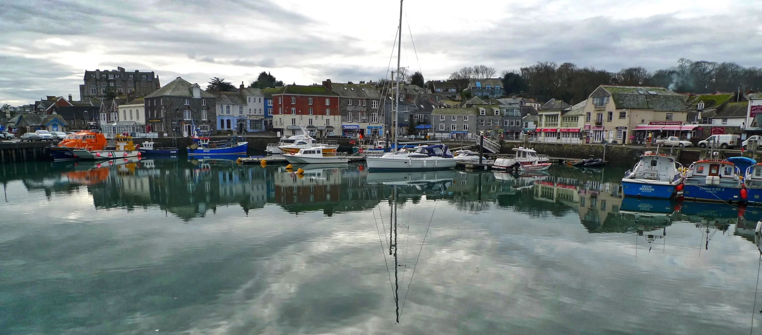
Padstow in winter