

Exmoor Walks: Withypool Common
Here’s a walk for winter – despite the conditions underfoot.
I have lived in my Exmoor valley 30 years now, and never during all that time have I known the paths so muddy. Luckily I came across a camera card containing some photographs I took during a dry and pleasant walk in central Exmoor that I enjoyed a few winters ago.

Central Exmoor near Willingford Bridge
It was one of those cold sunlit afternoons in which small white and slightly menacing clouds scud in from the Atlantic. We parked near Upper Willingford Bridge on the convergence of lovely Litton Water and Dane’s Brook (map ref: SS325 815).
In his book The Waters of Exmoor, Noel Allen tells us: “The Danes’ Brook probably takes its name from the hilly nature of the countryside through which it flows, or possibly from the twin mounds of Brewer’s Castle and Mounsey Castle which guard its junction with the River Barle.”
If you’re enjoying this article you might like the walk over Withypool Common

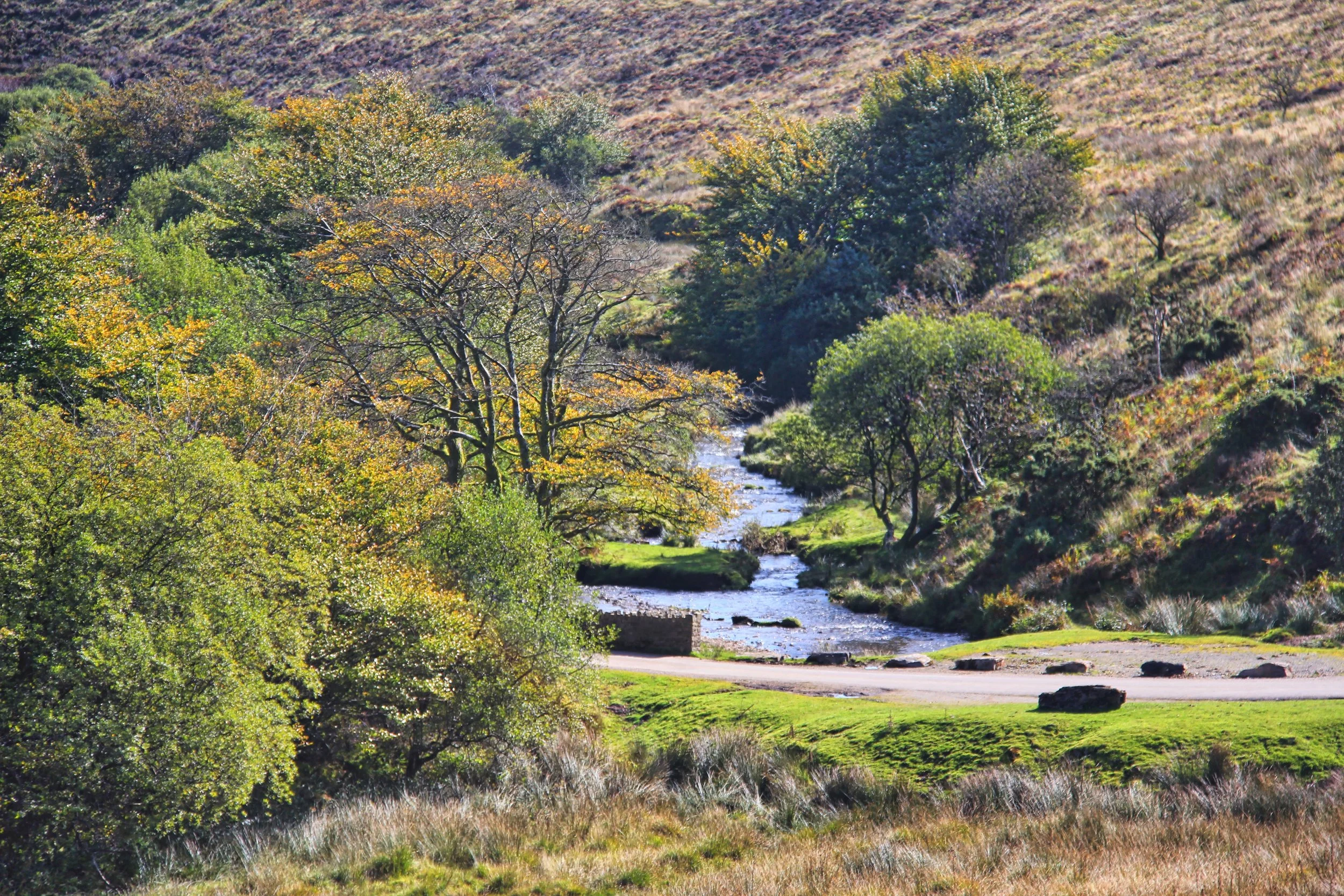
Th Barle at Withypool
This column has trudged in gorgeous glen before, this time we’re leaving the stream behind us to climb around the spur of hill due north towards Halscombe Allotment. After crossing a small tributary we bear right so that we can make for Porchester’s Post.
Now we enter the greater area of Withypool Common. From now on it is a story of verderers, free suitors, Court Leets and Lords of the Manor. As Exmoor writer Victor Bonham Carter once said in an essay for The Exmoor Review: “Withypool Common is a direct survival of the era when the Royal Forest of Exmoor was still an open waste, before the Inclosure Act of 1815; and it survived subsequent legislation by which many other commons on Exmoor were inclosed during the mid-19th century.
“Moreover, despite the vicissitudes of two worlds wars, the impact of tourism and of various measures for agricultural improvement, it is still being used in essentially the same manner as in the past: namely, as a grazing ground for stock, controlled by customary rights.”


By the way, that was written in 1968 when the impact of tourism was but a smidgen of what it is today. Later in the same extensive study of the common, research by Geoffrey Sinclair showed that on a fine weekday in August a mere four walkers appeared on Withypool Common. In a normal August in more recent times I bet you’d have counted more than 100 – but, of course, that could be much diminished next month if the rain continues to fall.

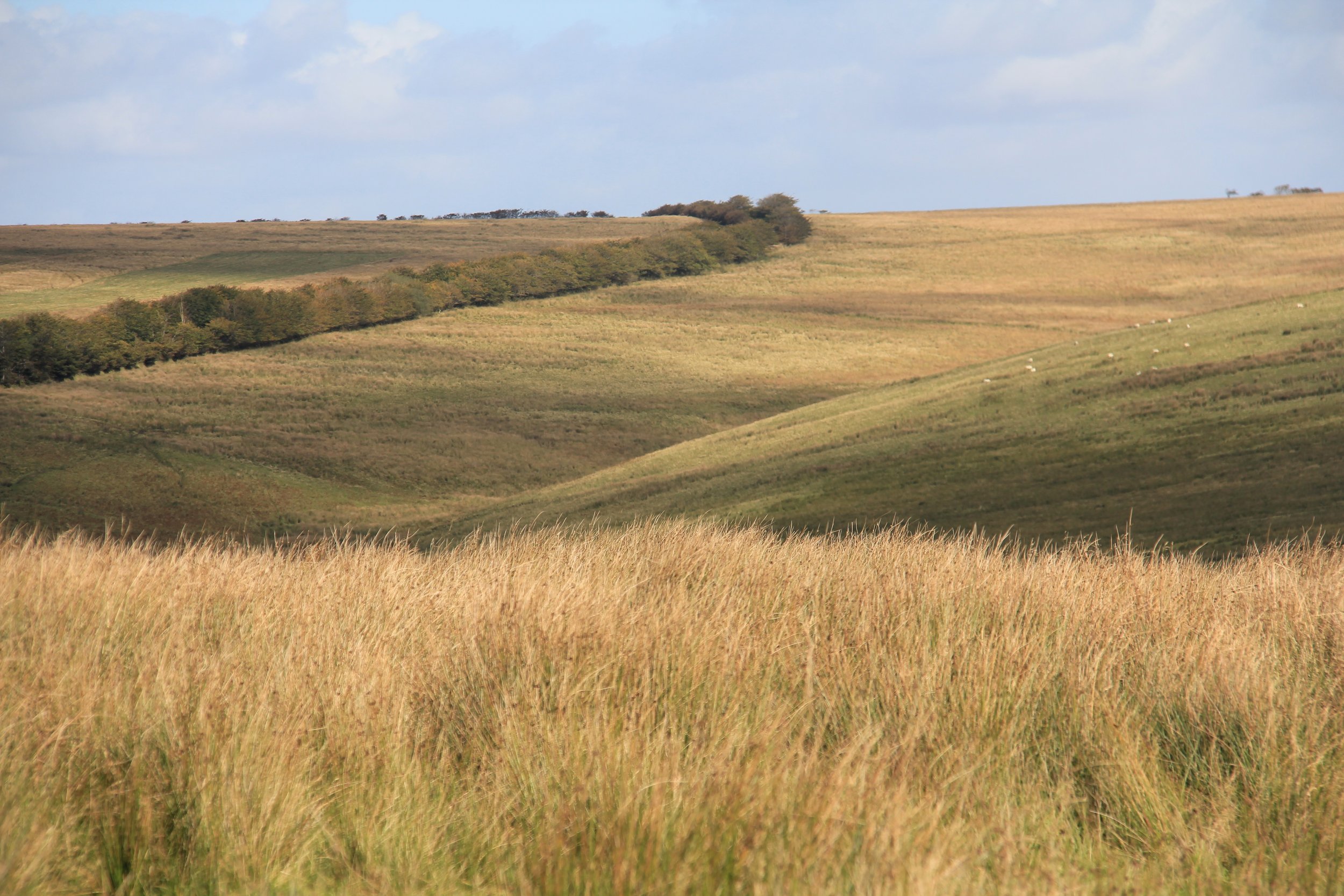
However, we were quite alone as we followed the hedge north west from Porchester’s Post. It took us to the Withypool road which we crossed so that we could continue on up to Brightworthy Burrows. At 428 metres this offers a fine prospect of central southern Exmoor. Way down to the west there’s famous Landacre Bridge looking lonely in the valley of the Barle – and if we spin slowly to our right we follow the river all the way to Withypool.


I always think there’s something peculiarly Scottish looking about Withypool. Perhaps it’s the way it nestles amid the moors, but perhaps too, it is something to do with the John Buchan-ish that dot its hillsides. Somehow you can imagine the man with the ‘hooded eyes’ – the villain of The 39 Steps, lurking in one of these expensive homes.
We dropped due north from the Burrows to reach the footpath that runs adjacent to the Barle. Again, this column has trudged this way before, so I won’t dally in my descriptions of the beautiful route east to the village.
If the pub is open, I heartily recommend taking refreshment there. If not, purchase something sustaining from the post office in preparation for your ascent of Withypool Hill. Cross back over the splendid old bridge and proceed up the Hawkridge road.

Looking downstream from the bridge at Withypool
No sooner had we left the village, we took to the moor and walked straight up to the summit. An alternative would be to follow the lane all the way to the cattle grid, where you can turn right to follow the bridleway alongside the edge of the moor.
The magnificent views available from the summit were fast beginning to fade when reached the tumulus at the top, so we carried on with barely a murmur, down past the ancient stone circle and eventually we joined the track that took us south west to a place called Tudball’s Splats.
Great name. Who Tudball was and what Splats are, I neither knew nor cared. I was growing weary as night fell and so we pushed on to regain our original route - past Porchester’s Post and south to Willingford Bridge.
Five of the nine miles we’d walked in daylight, three in the gloaming and one in utter darkness. And as the stars disappeared it started to rain. So what’s new?

Barle bridge at Withypool
Fact File
Basic hike: from Upper Willingford Bridge (map ref: SS325 815) north to Brightworthy Burrows, down to the footpath along the Barle, east to Withypool, and south to return over Withypool Hill.
Recommended map: Ordnance Survey Explorer OL 9 Exmoor.
Distance and going: nine miles, fairly easy going, can be a bit squelchy after rain.
Food and drink: Royal Oak, Withypool

